
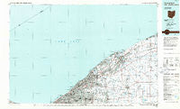
~ Cleveland North OH topo map, 1:100000 scale, 30 X 60 Minute, Historical, 1985, updated 1986
Cleveland North, Ohio, USGS topographic map dated 1985.
Includes geographic coordinates (latitude and longitude). This topographic map is suitable for hiking, camping, and exploring, or framing it as a wall map.
Printed on-demand using high resolution imagery, on heavy weight and acid free paper, or alternatively on a variety of synthetic materials.
Topos available on paper, Waterproof, Poly, or Tyvek. Usually shipping rolled, unless combined with other folded maps in one order.
- Product Number: USGS-5321476
- Free digital map download (high-resolution, GeoPDF): Cleveland North, Ohio (file size: 23 MB)
- Map Size: please refer to the dimensions of the GeoPDF map above
- Weight (paper map): ca. 55 grams
- Map Type: POD USGS Topographic Map
- Map Series: HTMC
- Map Verison: Historical
- Cell ID: 67310
- Scan ID: 226410
- Imprint Year: 1986
- Aerial Photo Year: 1982
- Edit Year: 1985
- Datum: NAD27
- Map Projection: Universal Transverse Mercator
- Planimetric: Yes
- Map published by United States Geological Survey
- Map Language: English
- Scanner Resolution: 600 dpi
- Map Cell Name: Cleveland North
- Grid size: 30 X 60 Minute
- Date on map: 1985
- Map Scale: 1:100000
- Geographical region: Ohio, United States
Neighboring Maps:
All neighboring USGS topo maps are available for sale online at a variety of scales.
Spatial coverage:
Topo map Cleveland North, Ohio, covers the geographical area associated the following places:
- Chagrin Harbor - Mentor - Rush Road (historical) - East Claridon - Willoughbeach - Little Italy - Brentwood - Manhattan Beach - Oak Hill Village - Four Points - Salida Beach - Wilder Senior Citizen Mobile Home Park North - Timberlake - Breakman - Josephatowa - Hambden - Orchard Mobile Home Park - Genung Corners - Clarks - Erie Side - North Munson - Avery Terrace - Will-O-Bee on the Lake - Brookwood Beach - James Place - Madison-on-the-Lake - Fairmount - Cleveland Heights - Chardon Centre (historical) - Mentor Green Mobile Home Park - Beardsley (historical) - Will-O-Wick - Pecks Corners - West Walnut Estates - Lyndhurst - Driftwood - Fowlers Mill - Perry Mobile Homes - Will-O-Way Beach - Chester Center - M And K Trailer Park - Painesville on-the-Lake - Doans Corners - Barnes Corners - Lakeline - Highland Heights - Five Points - Chesterland - South Church - Painesville - Collamer - Eagle Trailer Park - Little Mountain - Redbird - Euclid - Maple Ridge Community - Aquilla - Center Road (historical) - East Bass Lake - Chardon - Pease Mill (historical) - Lusard Place - Jacques High Chapparal Mobile Home Park - Lane - Heisley (historical) - Arcola Trailer Park - Mentor Acres - Bostwick - Terrace Glenn Estates - Clarks (historical) - South Euclid - South Madison - Arrowhead Beach - Pleasant Valley - Wheeler (historical) - Beulah Park - Concord Estates - Concord - Courtyard Mobile Home Park - Camp Roosevelt - Thompson - Mentor-on-the-Lake - South Thompson - Unionville - Johnson Mobile Home Park - Western Reserve Mobile Home Park - Reynolds - Buena Vista Beach - Leader's Mobile Home Park - Madison Dock (historical) - Euclid Beach Mobile Home Park - Collinwood - Grennan Mobile Village - Noble - Fairgrounds Mobile Home Park - Hach's Mobile Home Park - Mayfield - Scotland - Sands Community - Rustic Pine Mobile Home Park
- Map Area ID: AREA4241.5-82-81
- Northwest corner Lat/Long code: USGSNW42-82
- Northeast corner Lat/Long code: USGSNE42-81
- Southwest corner Lat/Long code: USGSSW41.5-82
- Southeast corner Lat/Long code: USGSSE41.5-81
- Northern map edge Latitude: 42
- Southern map edge Latitude: 41.5
- Western map edge Longitude: -82
- Eastern map edge Longitude: -81


