
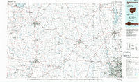
~ Bellefontaine OH topo map, 1:100000 scale, 30 X 60 Minute, Historical, 1986, updated 1986
Bellefontaine, Ohio, USGS topographic map dated 1986.
Includes geographic coordinates (latitude and longitude). This topographic map is suitable for hiking, camping, and exploring, or framing it as a wall map.
Printed on-demand using high resolution imagery, on heavy weight and acid free paper, or alternatively on a variety of synthetic materials.
Topos available on paper, Waterproof, Poly, or Tyvek. Usually shipping rolled, unless combined with other folded maps in one order.
- Product Number: USGS-5321462
- Free digital map download (high-resolution, GeoPDF): Bellefontaine, Ohio (file size: 15 MB)
- Map Size: please refer to the dimensions of the GeoPDF map above
- Weight (paper map): ca. 55 grams
- Map Type: POD USGS Topographic Map
- Map Series: HTMC
- Map Verison: Historical
- Cell ID: 67123
- Scan ID: 226286
- Imprint Year: 1986
- Aerial Photo Year: 1981
- Edit Year: 1986
- Datum: NAD27
- Map Projection: Universal Transverse Mercator
- Planimetric: Yes
- Map published by United States Geological Survey
- Map Language: English
- Scanner Resolution: 600 dpi
- Map Cell Name: Bellefontaine
- Grid size: 30 X 60 Minute
- Date on map: 1986
- Map Scale: 1:100000
- Geographical region: Ohio, United States
Neighboring Maps:
All neighboring USGS topo maps are available for sale online at a variety of scales.
Spatial coverage:
Topo map Bellefontaine, Ohio, covers the geographical area associated the following places:
- Unionville Center - Bellepoint - Horton - Zanesfield - Shawnee Hills - Green Pastures - Radnor - Powhattan - Woodview Park - Scioto Run - Plumwood - Oak Run - New California - Darnell - Saint Paris - The Knolls - Heritage Creek - Sandy Corners - Waldo - Powell - Huntsville - Middletown - Silver Springs - Olentangy Glade - Magnetic Springs - West Mansfield - Troyton - Klondike - Crimville (historical) - Olentangy High Bluffs - Wynstone - Anderson Meadows - Highway (historical) - River Landings - Gast Corner - Worthington Hills - Jones - Abbey Chase - Hampton Oaks - Richlanne Acres - Haynesville (historical) - Claiborne - Paris Court East - Sundale Mobile Home Park - Wayside Mobile Home Park - Troyer Mobile Home Park - Olentangy Crossings - Cable - Taylor Centre (historical) - Raymond - Urbana - Northwoods - Seagrave - Hyatts - Cherokee - Watkins - Delaware Meadows - Worthington - Riverlea - Mechanicsburg - Macochee Castle - Trails End - Ashleigh Village - Old Pimtown (historical) - Brookfield - Village At Lehner Woods - Troy Farms - Otter - Harper - Kennard - Lynn - Mackachack (historical) - Hoffman Farms - Stratford Woods - Marysville Estates - Northville - Countryside Mobile Home Park - Luxair - Millerstown - Windy Corner - Spunky Puddle (historical) - Lakes Edge Mobile Park - Millcreek Meadows - Dornoch Estates - Marl City - Kingscreek - Copperwood - Wammes Mobile Home Park - Rushsylvania - New Richland - Carrington Place - Syphrit Mobile Home Park - Dipple - Lakewood - Crystal Lake Mobile Home Park - Springhills - Gretna - Lewis Center - The Ravine - Wingate Farms
- Map Area ID: AREA40.540-84-83
- Northwest corner Lat/Long code: USGSNW40.5-84
- Northeast corner Lat/Long code: USGSNE40.5-83
- Southwest corner Lat/Long code: USGSSW40-84
- Southeast corner Lat/Long code: USGSSE40-83
- Northern map edge Latitude: 40.5
- Southern map edge Latitude: 40
- Western map edge Longitude: -84
- Eastern map edge Longitude: -83


