
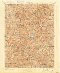
~ Wilkesville OH topo map, 1:62500 scale, 15 X 15 Minute, Historical, 1908, updated 1943
Wilkesville, Ohio, USGS topographic map dated 1908.
Includes geographic coordinates (latitude and longitude). This topographic map is suitable for hiking, camping, and exploring, or framing it as a wall map.
Printed on-demand using high resolution imagery, on heavy weight and acid free paper, or alternatively on a variety of synthetic materials.
Topos available on paper, Waterproof, Poly, or Tyvek. Usually shipping rolled, unless combined with other folded maps in one order.
- Product Number: USGS-5321424
- Free digital map download (high-resolution, GeoPDF): Wilkesville, Ohio (file size: 11 MB)
- Map Size: please refer to the dimensions of the GeoPDF map above
- Weight (paper map): ca. 55 grams
- Map Type: POD USGS Topographic Map
- Map Series: HTMC
- Map Verison: Historical
- Cell ID: 64547
- Scan ID: 226635
- Imprint Year: 1943
- Survey Year: 1905
- Datum: Unstated
- Map Projection: Polyconic
- Map published by United States Geological Survey
- Map Language: English
- Scanner Resolution: 600 dpi
- Map Cell Name: Wilkesville
- Grid size: 15 X 15 Minute
- Date on map: 1908
- Map Scale: 1:62500
- Geographical region: Ohio, United States
Neighboring Maps:
All neighboring USGS topo maps are available for sale online at a variety of scales.
Spatial coverage:
Topo map Wilkesville, Ohio, covers the geographical area associated the following places:
- Alice - Point Rock - Vinton - Oreton - Rowlesville - Salem Center - Zeal (historical) - Ewington - Wainwright - Clarion - Buckeye - Mount Blanco - Arbaugh - Keystone - Minerton - Prattsville - Dundas - Bolins Mills - Durgan - Pattonsville - Radcliff - Wilkesville - Puritan - Vales Mills - Danville - McArthur - Hawks - Mulga - Pincher (historical)
- Map Area ID: AREA39.2539-82.5-82.25
- Northwest corner Lat/Long code: USGSNW39.25-82.5
- Northeast corner Lat/Long code: USGSNE39.25-82.25
- Southwest corner Lat/Long code: USGSSW39-82.5
- Southeast corner Lat/Long code: USGSSE39-82.25
- Northern map edge Latitude: 39.25
- Southern map edge Latitude: 39
- Western map edge Longitude: -82.5
- Eastern map edge Longitude: -82.25


