
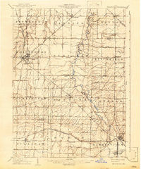
~ Wellington OH topo map, 1:62500 scale, 15 X 15 Minute, Historical, 1906, updated 1942
Wellington, Ohio, USGS topographic map dated 1906.
Includes geographic coordinates (latitude and longitude). This topographic map is suitable for hiking, camping, and exploring, or framing it as a wall map.
Printed on-demand using high resolution imagery, on heavy weight and acid free paper, or alternatively on a variety of synthetic materials.
Topos available on paper, Waterproof, Poly, or Tyvek. Usually shipping rolled, unless combined with other folded maps in one order.
- Product Number: USGS-5321394
- Free digital map download (high-resolution, GeoPDF): Wellington, Ohio (file size: 6 MB)
- Map Size: please refer to the dimensions of the GeoPDF map above
- Weight (paper map): ca. 55 grams
- Map Type: POD USGS Topographic Map
- Map Series: HTMC
- Map Verison: Historical
- Cell ID: 64368
- Scan ID: 226530
- Imprint Year: 1942
- Edit Year: 1942
- Survey Year: 1904
- Datum: Unstated
- Map Projection: Polyconic
- Map published by United States Geological Survey
- Map Language: English
- Scanner Resolution: 600 dpi
- Map Cell Name: Wellington
- Grid size: 15 X 15 Minute
- Date on map: 1906
- Map Scale: 1:62500
- Geographical region: Ohio, United States
Neighboring Maps:
All neighboring USGS topo maps are available for sale online at a variety of scales.
Spatial coverage:
Topo map Wellington, Ohio, covers the geographical area associated the following places:
- Edsel W Campbell Mobile Home Park - Brookside Mobile Home Park - Lagrange - Penfield - Evergreen Estates - Wellington Mobile Home Park - Esselburn - Lodi - Huntington - River Corners - Wellington - Pawnee - Chatham - Crawford Corners - Homer - Centerville (historical) - Spencer - Belden - Risley (historical) - Smith's Mobile Home Park - Pine Villas - Pittsfield - Geisingers Corners (historical) - Garden Isle - Sunset Mobile Home Park - Pheasant Run Village - Litchfield - Homerville - Sullivan - Newtons (historical)
- Map Area ID: AREA41.2541-82.25-82
- Northwest corner Lat/Long code: USGSNW41.25-82.25
- Northeast corner Lat/Long code: USGSNE41.25-82
- Southwest corner Lat/Long code: USGSSW41-82.25
- Southeast corner Lat/Long code: USGSSE41-82
- Northern map edge Latitude: 41.25
- Southern map edge Latitude: 41
- Western map edge Longitude: -82.25
- Eastern map edge Longitude: -82


