
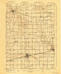
~ Wauseon OH topo map, 1:62500 scale, 15 X 15 Minute, Historical, 1913, updated 1941
Wauseon, Ohio, USGS topographic map dated 1913.
Includes geographic coordinates (latitude and longitude). This topographic map is suitable for hiking, camping, and exploring, or framing it as a wall map.
Printed on-demand using high resolution imagery, on heavy weight and acid free paper, or alternatively on a variety of synthetic materials.
Topos available on paper, Waterproof, Poly, or Tyvek. Usually shipping rolled, unless combined with other folded maps in one order.
- Product Number: USGS-5321378
- Free digital map download (high-resolution, GeoPDF): Wauseon, Ohio (file size: 6 MB)
- Map Size: please refer to the dimensions of the GeoPDF map above
- Weight (paper map): ca. 55 grams
- Map Type: POD USGS Topographic Map
- Map Series: HTMC
- Map Verison: Historical
- Cell ID: 64308
- Scan ID: 226499
- Imprint Year: 1941
- Survey Year: 1911
- Datum: Unstated
- Map Projection: Polyconic
- Map published by United States Geological Survey
- Map Language: English
- Scanner Resolution: 600 dpi
- Map Cell Name: Wauseon
- Grid size: 15 X 15 Minute
- Date on map: 1913
- Map Scale: 1:62500
- Geographical region: Ohio, United States
Neighboring Maps:
All neighboring USGS topo maps are available for sale online at a variety of scales.
Spatial coverage:
Topo map Wauseon, Ohio, covers the geographical area associated the following places:
- Oakshade - Wauseon - Plattston (historical) - Pettisville - Ottokee - Haller (historical) - Delta Heights - Advance - Inlet - Seward - Dover Glen - Thelma - Powers - Camelot South - Eckley - Star Mobile Court - Winameg - Ottokee Station - Morenci - Delta - West Delta - Tedrow - Timber Creek - Lyons - Denson
- Map Area ID: AREA41.7541.5-84.25-84
- Northwest corner Lat/Long code: USGSNW41.75-84.25
- Northeast corner Lat/Long code: USGSNE41.75-84
- Southwest corner Lat/Long code: USGSSW41.5-84.25
- Southeast corner Lat/Long code: USGSSE41.5-84
- Northern map edge Latitude: 41.75
- Southern map edge Latitude: 41.5
- Western map edge Longitude: -84.25
- Eastern map edge Longitude: -84


