
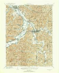
~ Uhrichsville OH topo map, 1:62500 scale, 15 X 15 Minute, Historical, 1909, updated 1956
Uhrichsville, Ohio, USGS topographic map dated 1909.
Includes geographic coordinates (latitude and longitude). This topographic map is suitable for hiking, camping, and exploring, or framing it as a wall map.
Printed on-demand using high resolution imagery, on heavy weight and acid free paper, or alternatively on a variety of synthetic materials.
Topos available on paper, Waterproof, Poly, or Tyvek. Usually shipping rolled, unless combined with other folded maps in one order.
- Product Number: USGS-5321358
- Free digital map download (high-resolution, GeoPDF): Uhrichsville, Ohio (file size: 11 MB)
- Map Size: please refer to the dimensions of the GeoPDF map above
- Weight (paper map): ca. 55 grams
- Map Type: POD USGS Topographic Map
- Map Series: HTMC
- Map Verison: Historical
- Cell ID: 63842
- Scan ID: 226842
- Imprint Year: 1956
- Survey Year: 1909
- Datum: NAD27
- Map Projection: Polyconic
- Map published by United States Geological Survey
- Map Language: English
- Scanner Resolution: 600 dpi
- Map Cell Name: Uhrichsville
- Grid size: 15 X 15 Minute
- Date on map: 1909
- Map Scale: 1:62500
- Geographical region: Ohio, United States
Neighboring Maps:
All neighboring USGS topo maps are available for sale online at a variety of scales.
Spatial coverage:
Topo map Uhrichsville, Ohio, covers the geographical area associated the following places:
- Quaker Mobile Home Park - Rockford - Yankeetown (historical) - Uhrichsville - Clearview Mobile Home Park - Pines Mobile Home Park - Schoenbrunn - New Philadelphia - Three Legs Town (historical) - Maurer Trailer Park - South Side - Roswell - Royal Lane Park - Wainwright - Gilmore - Midvale - Tuscarawas - Gnadenhutten - Odbert (historical) - Hartwood - Stillwater - Barnhill - Schoenbrunn Estates - J And M Mobile Home Park - Dennison - Feed Springs - Station 15 - Rock - Newport - Elm (historical) - Old Town - Shelmar Mobile Home Park - Brightwood - Rush - Riverside Park - Goshen - Roanoake - Eastport - Lock Seventeen - Tippecanoe
- Map Area ID: AREA40.540.25-81.5-81.25
- Northwest corner Lat/Long code: USGSNW40.5-81.5
- Northeast corner Lat/Long code: USGSNE40.5-81.25
- Southwest corner Lat/Long code: USGSSW40.25-81.5
- Southeast corner Lat/Long code: USGSSE40.25-81.25
- Northern map edge Latitude: 40.5
- Southern map edge Latitude: 40.25
- Western map edge Longitude: -81.5
- Eastern map edge Longitude: -81.25


