
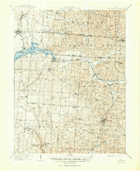
~ Thornville OH topo map, 1:62500 scale, 15 X 15 Minute, Historical, 1909, updated 1950
Thornville, Ohio, USGS topographic map dated 1909.
Includes geographic coordinates (latitude and longitude). This topographic map is suitable for hiking, camping, and exploring, or framing it as a wall map.
Printed on-demand using high resolution imagery, on heavy weight and acid free paper, or alternatively on a variety of synthetic materials.
Topos available on paper, Waterproof, Poly, or Tyvek. Usually shipping rolled, unless combined with other folded maps in one order.
- Product Number: USGS-5321342
- Free digital map download (high-resolution, GeoPDF): Thornville, Ohio (file size: 8 MB)
- Map Size: please refer to the dimensions of the GeoPDF map above
- Weight (paper map): ca. 55 grams
- Map Type: POD USGS Topographic Map
- Map Series: HTMC
- Map Verison: Historical
- Cell ID: 63538
- Scan ID: 226767
- Imprint Year: 1950
- Survey Year: 1907
- Datum: Unstated
- Map Projection: Polyconic
- Map published by United States Geological Survey
- Map Language: English
- Scanner Resolution: 600 dpi
- Map Cell Name: Thornville
- Grid size: 15 X 15 Minute
- Date on map: 1909
- Map Scale: 1:62500
- Geographical region: Ohio, United States
Neighboring Maps:
All neighboring USGS topo maps are available for sale online at a variety of scales.
Spatial coverage:
Topo map Thornville, Ohio, covers the geographical area associated the following places:
- Fairfield Beach - Harbor Hills - Atherton - Bruno - Hebron - Shell Beach - Firemans Park - Buckeye Lake - Moscow (historical) - Rushville - Somerset - Linnville - Glass Rock - Edgewater Beach - Chalfants - Thornport - Glenford - New Salem - Fleatown - Amsterdam - Jacksontown - Walser - Ziontown - Oakthorpe - New Reading - West Rushville - Wellan (historical) - Yost - Brownsville - Thornville
- Map Area ID: AREA4039.75-82.5-82.25
- Northwest corner Lat/Long code: USGSNW40-82.5
- Northeast corner Lat/Long code: USGSNE40-82.25
- Southwest corner Lat/Long code: USGSSW39.75-82.5
- Southeast corner Lat/Long code: USGSSE39.75-82.25
- Northern map edge Latitude: 40
- Southern map edge Latitude: 39.75
- Western map edge Longitude: -82.5
- Eastern map edge Longitude: -82.25


