
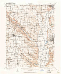
~ St Paris OH topo map, 1:62500 scale, 15 X 15 Minute, Historical, 1914, updated 1961
St Paris, Ohio, USGS topographic map dated 1914.
Includes geographic coordinates (latitude and longitude). This topographic map is suitable for hiking, camping, and exploring, or framing it as a wall map.
Printed on-demand using high resolution imagery, on heavy weight and acid free paper, or alternatively on a variety of synthetic materials.
Topos available on paper, Waterproof, Poly, or Tyvek. Usually shipping rolled, unless combined with other folded maps in one order.
- Product Number: USGS-5321324
- Free digital map download (high-resolution, GeoPDF): St Paris, Ohio (file size: 7 MB)
- Map Size: please refer to the dimensions of the GeoPDF map above
- Weight (paper map): ca. 55 grams
- Map Type: POD USGS Topographic Map
- Map Series: HTMC
- Map Verison: Historical
- Cell ID: 62005
- Scan ID: 227030
- Imprint Year: 1961
- Survey Year: 1914
- Datum: Unstated
- Map Projection: Polyconic
- Map published by United States Geological Survey
- Map Language: English
- Scanner Resolution: 600 dpi
- Map Cell Name: Saint Paris
- Grid size: 15 X 15 Minute
- Date on map: 1914
- Map Scale: 1:62500
- Geographical region: Ohio, United States
Neighboring Maps:
All neighboring USGS topo maps are available for sale online at a variety of scales.
Spatial coverage:
Topo map St Paris, Ohio, covers the geographical area associated the following places:
- Thackery - Rosewood - Paris Court West - Proctor (historical) - Bowlusville - Windy Corner - Paris Court East - Carysville - Westville - Tremont City - Crayon - Grandview Heights - Glen Echo - Terre Haute - Saint Paris - Urbana - Millerstown - Spunky Puddle (historical) - Old Pimtown (historical) - Eris - Lippincott - Northville - Darnell - Dialton - Harvest Square Mobile Home Park - Valley View Mobile Home Park - Nettleton (historical) - Owl Town (historical) - Bryar
- Map Area ID: AREA40.2540-84-83.75
- Northwest corner Lat/Long code: USGSNW40.25-84
- Northeast corner Lat/Long code: USGSNE40.25-83.75
- Southwest corner Lat/Long code: USGSSW40-84
- Southeast corner Lat/Long code: USGSSE40-83.75
- Northern map edge Latitude: 40.25
- Southern map edge Latitude: 40
- Western map edge Longitude: -84
- Eastern map edge Longitude: -83.75


