
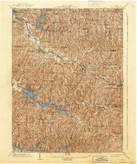
~ Scio OH topo map, 1:62500 scale, 15 X 15 Minute, Historical, 1904, updated 1944
Scio, Ohio, USGS topographic map dated 1904.
Includes geographic coordinates (latitude and longitude). This topographic map is suitable for hiking, camping, and exploring, or framing it as a wall map.
Printed on-demand using high resolution imagery, on heavy weight and acid free paper, or alternatively on a variety of synthetic materials.
Topos available on paper, Waterproof, Poly, or Tyvek. Usually shipping rolled, unless combined with other folded maps in one order.
- Product Number: USGS-5321284
- Free digital map download (high-resolution, GeoPDF): Scio, Ohio (file size: 12 MB)
- Map Size: please refer to the dimensions of the GeoPDF map above
- Weight (paper map): ca. 55 grams
- Map Type: POD USGS Topographic Map
- Map Series: HTMC
- Map Verison: Historical
- Cell ID: 62202
- Scan ID: 226938
- Imprint Year: 1944
- Survey Year: 1902
- Datum: Unstated
- Map Projection: Polyconic
- Map published by United States Geological Survey
- Map Language: English
- Scanner Resolution: 600 dpi
- Map Cell Name: Scio
- Grid size: 15 X 15 Minute
- Date on map: 1904
- Map Scale: 1:62500
- Geographical region: Ohio, United States
Neighboring Maps:
All neighboring USGS topo maps are available for sale online at a variety of scales.
Spatial coverage:
Topo map Scio, Ohio, covers the geographical area associated the following places:
- Leesville Glens - Laceyville (historical) - Conotton - West Shore Cottage Area - New Hagerstown - Bowerston - Perrysville - Leesville - Leesville Hills - Tappan - Leesville Lake Park - Sherrodsville - New Rumley - Kilgore - Hazelton - Jewett - Lakeshore Park - Moraville (historical) - East Shore Cottage Area - Glens Cottage Area - Thornhill - Deersville - Hanover - Enfield (historical) - Baltzell Trailer Court - Smithdale (historical) - Clendening (historical) - Pleasant Valley (historical) - Pines Cottage Area - Stacy (historical) - Rock Canyon Park - Hattonia (historical) - Palermo - Scio
- Map Area ID: AREA40.540.25-81.25-81
- Northwest corner Lat/Long code: USGSNW40.5-81.25
- Northeast corner Lat/Long code: USGSNE40.5-81
- Southwest corner Lat/Long code: USGSSW40.25-81.25
- Southeast corner Lat/Long code: USGSSE40.25-81
- Northern map edge Latitude: 40.5
- Southern map edge Latitude: 40.25
- Western map edge Longitude: -81.25
- Eastern map edge Longitude: -81


