
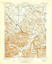
~ Roxabell OH topo map, 1:62500 scale, 15 X 15 Minute, Historical, 1912, updated 1958
Roxabell, Ohio, USGS topographic map dated 1912.
Includes geographic coordinates (latitude and longitude). This topographic map is suitable for hiking, camping, and exploring, or framing it as a wall map.
Printed on-demand using high resolution imagery, on heavy weight and acid free paper, or alternatively on a variety of synthetic materials.
Topos available on paper, Waterproof, Poly, or Tyvek. Usually shipping rolled, unless combined with other folded maps in one order.
- Product Number: USGS-5321252
- Free digital map download (high-resolution, GeoPDF): Roxabell, Ohio (file size: 8 MB)
- Map Size: please refer to the dimensions of the GeoPDF map above
- Weight (paper map): ca. 55 grams
- Map Type: POD USGS Topographic Map
- Map Series: HTMC
- Map Verison: Historical
- Cell ID: 61777
- Scan ID: 227244
- Imprint Year: 1958
- Survey Year: 1912
- Datum: NAD27
- Map Projection: Polyconic
- Map published by United States Geological Survey
- Map Language: English
- Scanner Resolution: 600 dpi
- Map Cell Name: Roxabell
- Grid size: 15 X 15 Minute
- Date on map: 1912
- Map Scale: 1:62500
- Geographical region: Ohio, United States
Neighboring Maps:
All neighboring USGS topo maps are available for sale online at a variety of scales.
Spatial coverage:
Topo map Roxabell, Ohio, covers the geographical area associated the following places:
- Slate Mills - Pleasant Valley - Sulphur Lick - View (historical) - Ebush (historical) - Brownstown (historical) - Andersonville - Musselman - Randall Terrace - Bourneville - Brownsville - Greenland - Brewer Heights - Anderson - Lattaville - Frankfort - Carey - North Fork Village - Roxabell - Maple Grove - Belleview Heights - Knockemstiff - Austin - Newingburg (historical)
- Map Area ID: AREA39.539.25-83.25-83
- Northwest corner Lat/Long code: USGSNW39.5-83.25
- Northeast corner Lat/Long code: USGSNE39.5-83
- Southwest corner Lat/Long code: USGSSW39.25-83.25
- Southeast corner Lat/Long code: USGSSE39.25-83
- Northern map edge Latitude: 39.5
- Southern map edge Latitude: 39.25
- Western map edge Longitude: -83.25
- Eastern map edge Longitude: -83


