
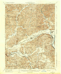
~ Frazeysburg OH topo map, 1:62500 scale, 15 X 15 Minute, Historical, 1910, updated 1937
Frazeysburg, Ohio, USGS topographic map dated 1910.
Includes geographic coordinates (latitude and longitude). This topographic map is suitable for hiking, camping, and exploring, or framing it as a wall map.
Printed on-demand using high resolution imagery, on heavy weight and acid free paper, or alternatively on a variety of synthetic materials.
Topos available on paper, Waterproof, Poly, or Tyvek. Usually shipping rolled, unless combined with other folded maps in one order.
- Product Number: USGS-5320914
- Free digital map download (high-resolution, GeoPDF): Frazeysburg, Ohio (file size: 10 MB)
- Map Size: please refer to the dimensions of the GeoPDF map above
- Weight (paper map): ca. 55 grams
- Map Type: POD USGS Topographic Map
- Map Series: HTMC
- Map Verison: Historical
- Cell ID: 54374
- Scan ID: 225093
- Imprint Year: 1937
- Survey Year: 1908
- Datum: Unstated
- Map Projection: Polyconic
- Map published by United States Geological Survey
- Map Language: English
- Scanner Resolution: 600 dpi
- Map Cell Name: Frazeysburg
- Grid size: 15 X 15 Minute
- Date on map: 1910
- Map Scale: 1:62500
- Geographical region: Ohio, United States
Neighboring Maps:
All neighboring USGS topo maps are available for sale online at a variety of scales.
Spatial coverage:
Topo map Frazeysburg, Ohio, covers the geographical area associated the following places:
- Dresden - Stringtown - Boston - Graham Corners - West Carlisle - Stonehenge - Black Run - Irville - Frazeysburg - Frampton - Claypools (historical) - Trinway - Shannon - Wakatomika - Wakatomika (historical) - Lower Dresden - Rock Haven Park - Cooperdale - Pleasant Valley (historical) - Nashport - Fallsburg - Perryton - Cottage Hill - Tilton Crossroads - Toboso - Woodcrest
- Map Area ID: AREA40.2540-82.25-82
- Northwest corner Lat/Long code: USGSNW40.25-82.25
- Northeast corner Lat/Long code: USGSNE40.25-82
- Southwest corner Lat/Long code: USGSSW40-82.25
- Southeast corner Lat/Long code: USGSSE40-82
- Northern map edge Latitude: 40.25
- Southern map edge Latitude: 40
- Western map edge Longitude: -82.25
- Eastern map edge Longitude: -82


