
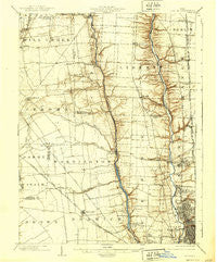
~ Dublin OH topo map, 1:62500 scale, 15 X 15 Minute, Historical, 1903, updated 1939
Dublin, Ohio, USGS topographic map dated 1903.
Includes geographic coordinates (latitude and longitude). This topographic map is suitable for hiking, camping, and exploring, or framing it as a wall map.
Printed on-demand using high resolution imagery, on heavy weight and acid free paper, or alternatively on a variety of synthetic materials.
Topos available on paper, Waterproof, Poly, or Tyvek. Usually shipping rolled, unless combined with other folded maps in one order.
- Product Number: USGS-5320854
- Free digital map download (high-resolution, GeoPDF): Dublin, Ohio (file size: 6 MB)
- Map Size: please refer to the dimensions of the GeoPDF map above
- Weight (paper map): ca. 55 grams
- Map Type: POD USGS Topographic Map
- Map Series: HTMC
- Map Verison: Historical
- Cell ID: 53570
- Scan ID: 224931
- Imprint Year: 1939
- Survey Year: 1901
- Datum: NAD
- Map Projection: Polyconic
- Map published by United States Geological Survey
- Map Language: English
- Scanner Resolution: 600 dpi
- Map Cell Name: Dublin
- Grid size: 15 X 15 Minute
- Date on map: 1903
- Map Scale: 1:62500
- Geographical region: Ohio, United States
Neighboring Maps:
All neighboring USGS topo maps are available for sale online at a variety of scales.
Spatial coverage:
Topo map Dublin, Ohio, covers the geographical area associated the following places:
- Estates At Braumiller - Lewis Center - Hampton Oaks - Heritage Lakes - Worthington - Hidden Springs - Westbriar - Hayden Run Village - Wingate Farms - Sandy Corners - Carrington Place - Braumiller Woods - Flint - Hilliard Heights - Glenross - Seagrave - Whisper Trace - North Orange - Richlanne Acres - Glen Oak - River Landings - Eastcleft - Olentangy - Olentangy Crossings - Davidson Run - Carriage Run - Hyde Park - Dublin - Shawnee Hills - Heritage Farms - Watkins - Olentangy High Bluffs - Anderson Meadows - Heather Ridge - Bridlespur - Hilliard Run - Brookfield - Oldfield Estates - Silver Springs - Nelson Farms - Scioto Run - Hayden - Brittany Oaks - Bellepoint - Northport Meadows - Hyatts - New California - Amlin - Village At North Falls - Ridgewood Estates - Abbey Chase - Cross Creek - Orange - Copperwood - Linworth - Lamb Corners - Millington - Ashleigh Village - Hampton Reserve - Britton Farms - Bayberry Creek - Coventry Manor - Brookbend - Dornoch Estates - Worthington Hills - The Suburbans Mobile Home Park - Highway (historical) - Westwind - Lakewood - Powell - Dorset Glen - Gregory - Worthington Arms - Mount Air - Luxair - Cheshire Crossing - Riverlea - Westbrooke Park - Shire Cove - Wynstone - Oak Run - Western Lakes - Rathbone - Hilliard - Kileville - Estates At Hoffman Farms - Darby Glen - Olentangy Glade - Jerome - Trails End - Olentangy Meadows - Northwoods - Avery Estates - Scioto Village - Heritage Creek - Hoffman Farms - Olentangy Falls - Mudsock
- Map Area ID: AREA40.2540-83.25-83
- Northwest corner Lat/Long code: USGSNW40.25-83.25
- Northeast corner Lat/Long code: USGSNE40.25-83
- Southwest corner Lat/Long code: USGSSW40-83.25
- Southeast corner Lat/Long code: USGSSE40-83
- Northern map edge Latitude: 40.25
- Southern map edge Latitude: 40
- Western map edge Longitude: -83.25
- Eastern map edge Longitude: -83


