
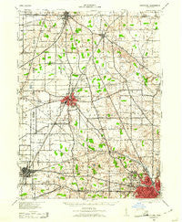
~ Crestline OH topo map, 1:62500 scale, 15 X 15 Minute, Historical, 1943, updated 1961
Crestline, Ohio, USGS topographic map dated 1943.
Includes geographic coordinates (latitude and longitude). This topographic map is suitable for hiking, camping, and exploring, or framing it as a wall map.
Printed on-demand using high resolution imagery, on heavy weight and acid free paper, or alternatively on a variety of synthetic materials.
Topos available on paper, Waterproof, Poly, or Tyvek. Usually shipping rolled, unless combined with other folded maps in one order.
- Product Number: USGS-5320818
- Free digital map download (high-resolution, GeoPDF): Crestline, Ohio (file size: 6 MB)
- Map Size: please refer to the dimensions of the GeoPDF map above
- Weight (paper map): ca. 55 grams
- Map Type: POD USGS Topographic Map
- Map Series: HTMC
- Map Verison: Historical
- Cell ID: 53082
- Scan ID: 224579
- Imprint Year: 1961
- Woodland Tint: Yes
- Aerial Photo Year: 1940
- Survey Year: 1913
- Datum: NAD
- Map Projection: Polyconic
- Map published by United States Army Corps of Engineers
- Map published by United States Department of War
- Map Language: English
- Scanner Resolution: 600 dpi
- Map Cell Name: Crestline
- Grid size: 15 X 15 Minute
- Date on map: 1943
- Map Scale: 1:62500
- Geographical region: Ohio, United States
Neighboring Maps:
All neighboring USGS topo maps are available for sale online at a variety of scales.
Spatial coverage:
Topo map Crestline, Ohio, covers the geographical area associated the following places:
- Capri Mobile Home Park - Shiloh - Vernon Junction - Riblet (historical) - East Crestline - Dale Avenue Mobile Home Park - Stewart (historical) - Bethlehem - Mobile Manor Park - Forest (historical) - Planktown - Roseland - Shelby Mobile Home Park - Spring Grove (historical) - Shelby - London - Ontario - Auburn Center - Amoy - Briarwood Estates Mobile Home Park - New Pittsburgh - Spring Mill - Plymouth - Five Corners - Myers (historical) - Sunnyview - Toledo Junction - Midpoint Woods - Maybee - Crestline - Pinecrest Mobile Home Park - Ganges - Richland (historical) - Meadowood Estates Mobile Home Park - Pine Grove Mobile Estates - Carefree Estates - Hines (historical) - Gardner - Mansfield - Rome - Taylortown - Woodside Estates Mobile Home Park
- Map Area ID: AREA4140.75-82.75-82.5
- Northwest corner Lat/Long code: USGSNW41-82.75
- Northeast corner Lat/Long code: USGSNE41-82.5
- Southwest corner Lat/Long code: USGSSW40.75-82.75
- Southeast corner Lat/Long code: USGSSE40.75-82.5
- Northern map edge Latitude: 41
- Southern map edge Latitude: 40.75
- Western map edge Longitude: -82.75
- Eastern map edge Longitude: -82.5


