
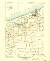
~ Conneaut OH topo map, 1:62500 scale, 15 X 15 Minute, Historical, 1906, updated 1950
Conneaut, Ohio, USGS topographic map dated 1906.
Includes geographic coordinates (latitude and longitude). This topographic map is suitable for hiking, camping, and exploring, or framing it as a wall map.
Printed on-demand using high resolution imagery, on heavy weight and acid free paper, or alternatively on a variety of synthetic materials.
Topos available on paper, Waterproof, Poly, or Tyvek. Usually shipping rolled, unless combined with other folded maps in one order.
- Product Number: USGS-5320800
- Free digital map download (high-resolution, GeoPDF): Conneaut, Ohio (file size: 5 MB)
- Map Size: please refer to the dimensions of the GeoPDF map above
- Weight (paper map): ca. 55 grams
- Map Type: POD USGS Topographic Map
- Map Series: HTMC
- Map Verison: Historical
- Cell ID: 52876
- Scan ID: 224541
- Imprint Year: 1950
- Survey Year: 1904
- Datum: Unstated
- Map Projection: Polyconic
- Map published by United States Geological Survey
- Map Language: English
- Scanner Resolution: 600 dpi
- Map Cell Name: Conneaut
- Grid size: 15 X 15 Minute
- Date on map: 1906
- Map Scale: 1:62500
- Geographical region: Ohio, United States
Neighboring Maps:
All neighboring USGS topo maps are available for sale online at a variety of scales.
Spatial coverage:
Topo map Conneaut, Ohio, covers the geographical area associated the following places:
- Farnham - Lakeville - Amboy - Camp Luther - Southwood Colony - Kingsville On-the-Lake - Shipp - Mobile Acres - Camp Calvary - Green Acres - East Conneaut - Kingsville - Plymouth - Ollins Corners - Gageville - Kelloggsville - North Kingsville - Riggs - Conneaut - Bulah - Bushnell - Denmark Center - Monroe Center - Taylor Mobile Home Park - Sheffield Center - Theil's Mobile Home Park - Mobile Grove Trailer Park
- Map Area ID: AREA4241.75-80.75-80.5
- Northwest corner Lat/Long code: USGSNW42-80.75
- Northeast corner Lat/Long code: USGSNE42-80.5
- Southwest corner Lat/Long code: USGSSW41.75-80.75
- Southeast corner Lat/Long code: USGSSE41.75-80.5
- Northern map edge Latitude: 42
- Southern map edge Latitude: 41.75
- Western map edge Longitude: -80.75
- Eastern map edge Longitude: -80.5


