
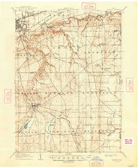
~ Chardon OH topo map, 1:62500 scale, 15 X 15 Minute, Historical, 1906, updated 1948
Chardon, Ohio, USGS topographic map dated 1906.
Includes geographic coordinates (latitude and longitude). This topographic map is suitable for hiking, camping, and exploring, or framing it as a wall map.
Printed on-demand using high resolution imagery, on heavy weight and acid free paper, or alternatively on a variety of synthetic materials.
Topos available on paper, Waterproof, Poly, or Tyvek. Usually shipping rolled, unless combined with other folded maps in one order.
- Product Number: USGS-5320758
- Free digital map download (high-resolution, GeoPDF): Chardon, Ohio (file size: 6 MB)
- Map Size: please refer to the dimensions of the GeoPDF map above
- Weight (paper map): ca. 55 grams
- Map Type: POD USGS Topographic Map
- Map Series: HTMC
- Map Verison: Historical
- Cell ID: 52410
- Scan ID: 224385
- Imprint Year: 1948
- Survey Year: 1904
- Datum: Unstated
- Map Projection: Polyconic
- Map published by United States Geological Survey
- Map Language: English
- Scanner Resolution: 600 dpi
- Map Cell Name: Chardon
- Grid size: 15 X 15 Minute
- Date on map: 1906
- Map Scale: 1:62500
- Geographical region: Ohio, United States
Neighboring Maps:
All neighboring USGS topo maps are available for sale online at a variety of scales.
Spatial coverage:
Topo map Chardon, Ohio, covers the geographical area associated the following places:
- Center Road (historical) - Hambden - Montville - Avery Terrace - East Claridon - East Bass Lake - Grennan Mobile Village - Leader's Mobile Home Park - Jacques High Chapparal Mobile Home Park - Huntsburg - Aquilla - Chardon Centre (historical) - Claridon - Five Points - Rustic Pine Mobile Home Park - Lusard Place - Clarks - Beardsley (historical) - Wheeler (historical) - Maple Ridge Community - Pease Mill (historical) - Terrace Glenn Estates - Breakman - Springlake Trailer Park - Painesville - Thompson - Calm (historical) - Chardon - South Thompson - Bostwick - Barnes Corners - Clarks (historical) - South Madison - Concord - West Bass Lake
- Map Area ID: AREA41.7541.5-81.25-81
- Northwest corner Lat/Long code: USGSNW41.75-81.25
- Northeast corner Lat/Long code: USGSNE41.75-81
- Southwest corner Lat/Long code: USGSSW41.5-81.25
- Southeast corner Lat/Long code: USGSSE41.5-81
- Northern map edge Latitude: 41.75
- Southern map edge Latitude: 41.5
- Western map edge Longitude: -81.25
- Eastern map edge Longitude: -81


