
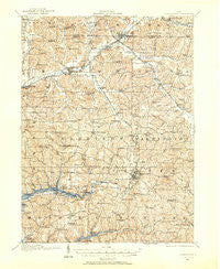
~ Carrollton OH topo map, 1:62500 scale, 15 X 15 Minute, Historical, 1910, updated 1957
Carrollton, Ohio, USGS topographic map dated 1910.
Includes geographic coordinates (latitude and longitude). This topographic map is suitable for hiking, camping, and exploring, or framing it as a wall map.
Printed on-demand using high resolution imagery, on heavy weight and acid free paper, or alternatively on a variety of synthetic materials.
Topos available on paper, Waterproof, Poly, or Tyvek. Usually shipping rolled, unless combined with other folded maps in one order.
- Product Number: USGS-5320730
- Free digital map download (high-resolution, GeoPDF): Carrollton, Ohio (file size: 10 MB)
- Map Size: please refer to the dimensions of the GeoPDF map above
- Weight (paper map): ca. 55 grams
- Map Type: POD USGS Topographic Map
- Map Series: HTMC
- Map Verison: Historical
- Cell ID: 52212
- Scan ID: 224324
- Imprint Year: 1957
- Survey Year: 1910
- Datum: NAD27
- Map Projection: Polyconic
- Map published by United States Geological Survey
- Map Language: English
- Scanner Resolution: 600 dpi
- Map Cell Name: Carrollton
- Grid size: 15 X 15 Minute
- Date on map: 1910
- Map Scale: 1:62500
- Geographical region: Ohio, United States
Neighboring Maps:
All neighboring USGS topo maps are available for sale online at a variety of scales.
Spatial coverage:
Topo map Carrollton, Ohio, covers the geographical area associated the following places:
- Queensboro - Carroll View Terrace - Atwood Crossing - Hickory Grove - Atwood Cove - Toots Crossroads - Pattersonville - Minerva Junction - Rolling Meadow Acres - Grampian Hills - Pine Hill - Hibbetts - Paradise Point - Piney View - Minerva - Pekin - Minor's Mobile Home Park - Malvern - Leavittsville - Mapleton - Waterloo - Pines Cottage Area - Lake Mohawk - Rockwood Park - Skyland Pines Mobile Home Park - Arrowhead - Morges - Tabor - Atwood (historical) - Lakeview - New Harrisburg - Atwood Village - Carrollton - Atwood Valley - Augusta - Hills Trailer Court - Bon Air Estates - Kidder Trailer Park - Palermo-on-the-Lakes - Cove Cottage Area - Washington Hall - Oneida - Stemple - Woodale Village Mobile Home Park - Becki Lynn Court - Dutch Corners - Harlem Springs - Specht - Town And Country Park Estates - Wyncrest - Watheys - Petersburgh - Eckley - Heritage Hills - Pigtown - Dellroy - East Rochester - Rolling Homes - Atwood Pines - Glenmar - Leyda - Valleyview - Sandy Hills Estates - Wherrys Crossroads - Fritchleys Corners
- Map Area ID: AREA40.7540.5-81.25-81
- Northwest corner Lat/Long code: USGSNW40.75-81.25
- Northeast corner Lat/Long code: USGSNE40.75-81
- Southwest corner Lat/Long code: USGSSW40.5-81.25
- Southeast corner Lat/Long code: USGSSE40.5-81
- Northern map edge Latitude: 40.75
- Southern map edge Latitude: 40.5
- Western map edge Longitude: -81.25
- Eastern map edge Longitude: -81


