
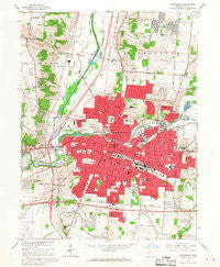
~ Springfield OH topo map, 1:24000 scale, 7.5 X 7.5 Minute, Historical, 1966, updated 1968
Springfield, Ohio, USGS topographic map dated 1966.
Includes geographic coordinates (latitude and longitude). This topographic map is suitable for hiking, camping, and exploring, or framing it as a wall map.
Printed on-demand using high resolution imagery, on heavy weight and acid free paper, or alternatively on a variety of synthetic materials.
Topos available on paper, Waterproof, Poly, or Tyvek. Usually shipping rolled, unless combined with other folded maps in one order.
- Product Number: USGS-5319602
- Free digital map download (high-resolution, GeoPDF): Springfield, Ohio (file size: 11 MB)
- Map Size: please refer to the dimensions of the GeoPDF map above
- Weight (paper map): ca. 55 grams
- Map Type: POD USGS Topographic Map
- Map Series: HTMC
- Map Verison: Historical
- Cell ID: 42681
- Scan ID: 227020
- Imprint Year: 1968
- Woodland Tint: Yes
- Photo Revision Year: 1966
- Aerial Photo Year: 1954
- Field Check Year: 1955
- Datum: NAD27
- Map Projection: Polyconic
- Map published by United States Geological Survey
- Map published by United States Army
- Map Language: English
- Scanner Resolution: 600 dpi
- Map Cell Name: Springfield
- Grid size: 7.5 X 7.5 Minute
- Date on map: 1966
- Map Scale: 1:24000
- Geographical region: Ohio, United States
Neighboring Maps:
All neighboring USGS topo maps are available for sale online at a variety of scales.
Spatial coverage:
Topo map Springfield, Ohio, covers the geographical area associated the following places:
- Locustgrove - Walnut Hills - Shawnee Acres - Melrose (historical) - Crabill Road Farms - Jacksonville - Seans Woods - Southgate - Rose Garden Mobile Home Park - Eagle City - Villa - Oakcrest - Limecrest - Miracle Mile - Green Hedges - Springfield Station (historical) - Sherwood Park - Olympic Hills - Southridge - Terra Cella Manor - Riceville (historical) - Belmont Meadows - Beatty - Sun Valley - Clearview Mobile Home Park - Oakwood Village - Northridge - Eastview Heights - Bon Air Mobile Home Park - Snyders Mill - Westridge - Happy Valley Mobile Home Park - Warder Park - Dal-Mar Mobile Home Park - Layne - Upper Fox Hollow - Ridgewood - Edgewood Farms - Sunnyland - Springfield - Kenwood Heights - Park Ridge Acres - Snyder Terrace - North Hill - Greenlawn Village - Glencoe Estates - Forest Hills - Home Orchards - Shoups Mobile Home Park - Lagonda - Rolling Terrace Mobile Home Park - Cheviot Hills - Possum Woods - Meadow Lane - Kingsgate Commons
- Map Area ID: AREA4039.875-83.875-83.75
- Northwest corner Lat/Long code: USGSNW40-83.875
- Northeast corner Lat/Long code: USGSNE40-83.75
- Southwest corner Lat/Long code: USGSSW39.875-83.875
- Southeast corner Lat/Long code: USGSSE39.875-83.75
- Northern map edge Latitude: 40
- Southern map edge Latitude: 39.875
- Western map edge Longitude: -83.875
- Eastern map edge Longitude: -83.75


