
~ Dry Prairie OR topo map, 1:24000 scale, 7.5 X 7.5 Minute, Historical, 2011
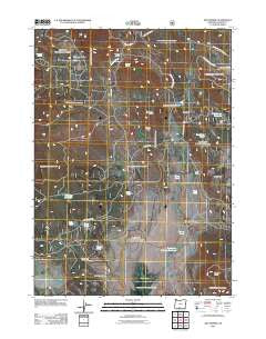
Dry Prairie, Oregon, USGS topographic map dated 2011.
Includes geographic coordinates (latitude and longitude). This topographic map is suitable for hiking, camping, and exploring, or framing it as a wall map.
Printed on-demand using high resolution imagery, on heavy weight and acid free paper, or alternatively on a variety of synthetic materials.
Topos available on paper, Waterproof, Poly, or Tyvek. Usually shipping rolled, unless combined with other folded maps in one order.
- Product Number: USGS-5295555
- Free digital map download (high-resolution, GeoPDF): Dry Prairie, Oregon (file size: 26 MB)
- Map Size: please refer to the dimensions of the GeoPDF map above
- Weight (paper map): ca. 55 grams
- Map Type: POD USGS Topographic Map
- Map Series: US Topo
- Map Verison: Historical
- Cell ID: 12871
- Datum: North American Datum of 1983
- Map Projection: Transverse Mercator
- Map Cell Name: Dry Prairie
- Grid size: 7.5 X 7.5 Minute
- Date on map: 2011
- Map Scale: 1:24000
- Geographical region: Oregon, United States
Neighboring Maps:
All neighboring USGS topo maps are available for sale online at a variety of scales.
Spatial coverage:
Topo map Dry Prairie, Oregon, covers the geographical area associated the following places:
- Manhattan Spring - Dry Gulch - Dry Prairie - Royston Post Office (historical) - Mineral Prairie - Dead Spring - Buckmaster Flat - Nuthatch Springs - Vinson Pond - Miner Pond - Gerber Rim - Vinson Ranch - Gully Pond - Wilson Ranch - Dry Prairie Number One Pond - Buckmaster Spring - Forty Pond - O'Connor Reservoir - Yellow Jacket Spring - Dry Gulch Pond - James Spring - Prairie Pond - Horse Canyon Spring - Summit Prairie - Tumble Spring - Horn Pond - Mineral Spring - Chipmunk Spring - Seven Springs - Yellow Jacket Flat - Near Pond - Wild Spring - Deadman Well - Willow Flat Reservoir - Dry Prairie Reservoir - Thimbleberry Spring - Coyote Butte - Murray Field - Royston Spring - James Butte - Paddock Butte - Painter Spring - Willow Flat - Hungry Hollow - Goop Spring
- Map Area ID: AREA42.37542.25-121.25-121.125
- Northwest corner Lat/Long code: USGSNW42.375-121.25
- Northeast corner Lat/Long code: USGSNE42.375-121.125
- Southwest corner Lat/Long code: USGSSW42.25-121.25
- Southeast corner Lat/Long code: USGSSE42.25-121.125
- Northern map edge Latitude: 42.375
- Southern map edge Latitude: 42.25
- Western map edge Longitude: -121.25
- Eastern map edge Longitude: -121.125


