
~ Evansville IN topo map, 1:250000 scale, 1 X 2 Degree, Historical, 1957, updated 1975
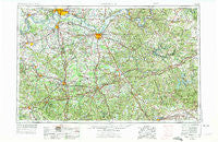
Evansville, Indiana, USGS topographic map dated 1957.
Includes geographic coordinates (latitude and longitude). This topographic map is suitable for hiking, camping, and exploring, or framing it as a wall map.
Printed on-demand using high resolution imagery, on heavy weight and acid free paper, or alternatively on a variety of synthetic materials.
Topos available on paper, Waterproof, Poly, or Tyvek. Usually shipping rolled, unless combined with other folded maps in one order.
- Product Number: USGS-5289224
- Free digital map download (high-resolution, GeoPDF): Evansville, Indiana (file size: 19 MB)
- Map Size: please refer to the dimensions of the GeoPDF map above
- Weight (paper map): ca. 55 grams
- Map Type: POD USGS Topographic Map
- Map Series: HTMC
- Map Verison: Historical
- Cell ID: 68772
- Scan ID: 156914
- Imprint Year: 1975
- Woodland Tint: Yes
- Visual Version Number: 2
- Photo Revision Year: 1974
- Aerial Photo Year: 1972
- Edit Year: 1974
- Datum: Unstated
- Map Projection: Transverse Mercator
- Map published by United States Geological Survey
- Map Language: English
- Scanner Resolution: 600 dpi
- Map Cell Name: Evansville
- Grid size: 1 X 2 Degree
- Date on map: 1957
- Map Scale: 1:250000
- Geographical region: Indiana, United States
Neighboring Maps:
All neighboring USGS topo maps are available for sale online at a variety of scales.
Spatial coverage:
Topo map Evansville, Indiana, covers the geographical area associated the following places:
- Rockland - High Plains Corner - Hollinsworth Post Office (historical) - Saint Vincent - Leitchfield - Graysville - Farmersville - Flener - Island - Briarfield (historical) - Utica - Pates (historical) - White Mills Junction - Empire - Ollie - Hensley - Belton - Briarfield (historical) - Indian Valley - Chestnut Grove (historical) - Breckinridge Center - Mannington - Cave Spring - Cools Spring (historical) - Robinsville - Ridge (historical) - Eastview - Southard - Dozier Heights - Asphalt - Cherry Hill (historical) - Echols - Eveleigh - Big Reedy - Dalton - Snyder - Elmwood - Moorman - Brentwood - Floral - Mount Carmel - Nelson - Chelsea (historical) - Red Hill - Union Temple (historical) - Diamond Springs - Arnold - Richelieu - West Wheatcroft - Pearman - Lilac - Duff - Needmore - Rock Springs - Flat Creek (historical) - Pelzer - Millshed (historical) - Oak Ridge - Millwood - Geneva - Sample - Parish - Utley Ford - Arnold (historical) - Dovey (historical) - Highland Springs - McHenry - Big Windy - Tousey - Rangers Landing - Monford - Quality - Arthur - Brooklyn - Owensboro - Pine Knob - Dead Mans Crossing - Slate Bank (historical) - Dulaney - Jernigan Chapel (historical) - Goering - Custer - Do Stop - Oklahoma - Roseville - Waverly - Pumpkin Center - Maxwell - Browder - Lilmay (historical) - Adams (historical) - Ellmitch - Lisman - Higdon - Bells Run - Cleaton - Midway - Creswell - Beaver Dam - Patronville
- Map Area ID: AREA3837-88-86
- Northwest corner Lat/Long code: USGSNW38-88
- Northeast corner Lat/Long code: USGSNE38-86
- Southwest corner Lat/Long code: USGSSW37-88
- Southeast corner Lat/Long code: USGSSE37-86
- Northern map edge Latitude: 38
- Southern map edge Latitude: 37
- Western map edge Longitude: -88
- Eastern map edge Longitude: -86


