
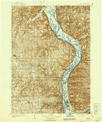
~ Waukon IA topo map, 1:125000 scale, 30 X 30 Minute, Historical, 1903, updated 1944
Waukon, Iowa, USGS topographic map dated 1903.
Includes geographic coordinates (latitude and longitude). This topographic map is suitable for hiking, camping, and exploring, or framing it as a wall map.
Printed on-demand using high resolution imagery, on heavy weight and acid free paper, or alternatively on a variety of synthetic materials.
Topos available on paper, Waterproof, Poly, or Tyvek. Usually shipping rolled, unless combined with other folded maps in one order.
- Product Number: USGS-5283793
- Free digital map download (high-resolution, GeoPDF): Waukon, Iowa (file size: 10 MB)
- Map Size: please refer to the dimensions of the GeoPDF map above
- Weight (paper map): ca. 55 grams
- Map Type: POD USGS Topographic Map
- Map Series: HTMC
- Map Verison: Historical
- Cell ID: 66899
- Scan ID: 175715
- Imprint Year: 1944
- Survey Year: 1900
- Datum: Unstated
- Map Projection: Unstated
- Map published by United States Geological Survey
- Keywords: Nonstandard Press Run
- Map Language: English
- Scanner Resolution: 600 dpi
- Map Cell Name: Waukon
- Grid size: 30 X 30 Minute
- Date on map: 1903
- Map Scale: 1:125000
- Geographical region: Iowa, United States
Neighboring Maps:
All neighboring USGS topo maps are available for sale online at a variety of scales.
Spatial coverage:
Topo map Waukon, Iowa, covers the geographical area associated the following places:
- Dalby - New Albin - Waterville - Selchs Mobile Home Park - Valdora (historical) - Retreat - Village Creek - Luana - Yellow River - La Prairie Retirement Village - Lyndale - Waukon Junction - Bridgeport - Lynxville - Froelich - Watson - Hardin - Reed - Rossville - Maud - Sixteen - De Soto - Giard Station (historical) - Lycurgus - McGregor - McGregor Heights - Egan - Marquette - Church - Giard - Eastman - Waukon - Lansing - Eldergrove - Thompson Corner - Harpers Ferry - Ion - Elon - West Prairie - Prairie du Chien - West Yards - White Corners - Beulah - Volney - Ferryville - Charme - Lansing Valley Mobile City - Monona - Red Mound - Victory
- Map Area ID: AREA43.543-91.5-91
- Northwest corner Lat/Long code: USGSNW43.5-91.5
- Northeast corner Lat/Long code: USGSNE43.5-91
- Southwest corner Lat/Long code: USGSSW43-91.5
- Southeast corner Lat/Long code: USGSSE43-91
- Northern map edge Latitude: 43.5
- Southern map edge Latitude: 43
- Western map edge Longitude: -91.5
- Eastern map edge Longitude: -91


