
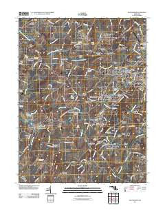
~ New Windsor MD topo map, 1:24000 scale, 7.5 X 7.5 Minute, Historical, 2011
New Windsor, Maryland, USGS topographic map dated 2011.
Includes geographic coordinates (latitude and longitude). This topographic map is suitable for hiking, camping, and exploring, or framing it as a wall map.
Printed on-demand using high resolution imagery, on heavy weight and acid free paper, or alternatively on a variety of synthetic materials.
Topos available on paper, Waterproof, Poly, or Tyvek. Usually shipping rolled, unless combined with other folded maps in one order.
- Product Number: USGS-5270968
- Free digital map download (high-resolution, GeoPDF): New Windsor, Maryland (file size: 19 MB)
- Map Size: please refer to the dimensions of the GeoPDF map above
- Weight (paper map): ca. 55 grams
- Map Type: POD USGS Topographic Map
- Map Series: US Topo
- Map Verison: Historical
- Cell ID: 31882
- Datum: North American Datum of 1983
- Map Projection: Transverse Mercator
- Map Cell Name: New Windsor
- Grid size: 7.5 X 7.5 Minute
- Date on map: 2011
- Map Scale: 1:24000
- Geographical region: Maryland, United States
Neighboring Maps:
All neighboring USGS topo maps are available for sale online at a variety of scales.
Spatial coverage:
Topo map New Windsor, Maryland, covers the geographical area associated the following places:
- Mill Brothers Hills - Wakefield - Bowercrest Park - Avondale Run - Whispering Meadows - Charloumyr - Amanda Hills - New Windsor - Jasontown - Maring Manor - Marston - Daisy Ridge - Jessie Anne Estates - Wagners Mill - Chadwick Court - Ridgeview Estates - The Hermitage - Clear Ridge - Shipley - Wakefield Mill - Pinch Valley Estates - Marbeth Hill - Rockland Estates - Stevenson Garden Estates - Frizzellburg - Chapel Heights - Catoctin View - Tri-Woods - Wedgewood Terrace - View West Acres - Medford - Wakefield Valley - Mountain View - Avondale - Panorama Estates - Wakefield Estates - Joseph Meadows - Narnia - Roop Mill - Carrollyn Manor - Whistling Ridge Estates - Uniontown - Forest Hills - Baile - Myers Acres - Spring Mills - Michaels Ridge - Snowdens Manor - Belle Grove Square - Carroll Lutheran Village - Avondale Ridge - Tyrone Acres - Warfieldsburg - Walnut Hill - Sunset Vista - Blue Ridge View - Fountain Valley - The Meadows - Rolling Ridge - Hannleigh Heights - Bailes Mill - Parrs Ridge - Happy Acres - Omar Acres - Furnace Hills - Somerset - The Fairways at Wakefield - Canterbury - Pleasant Dale - Tyrone
- Map Area ID: AREA39.62539.5-77.125-77
- Northwest corner Lat/Long code: USGSNW39.625-77.125
- Northeast corner Lat/Long code: USGSNE39.625-77
- Southwest corner Lat/Long code: USGSSW39.5-77.125
- Southeast corner Lat/Long code: USGSSE39.5-77
- Northern map edge Latitude: 39.625
- Southern map edge Latitude: 39.5
- Western map edge Longitude: -77.125
- Eastern map edge Longitude: -77


