
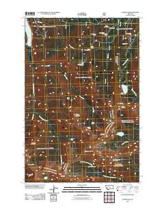
~ Storm Lake MT topo map, 1:24000 scale, 7.5 X 7.5 Minute, Historical, 2011
Storm Lake, Montana, USGS topographic map dated 2011.
Includes geographic coordinates (latitude and longitude). This topographic map is suitable for hiking, camping, and exploring, or framing it as a wall map.
Printed on-demand using high resolution imagery, on heavy weight and acid free paper, or alternatively on a variety of synthetic materials.
Topos available on paper, Waterproof, Poly, or Tyvek. Usually shipping rolled, unless combined with other folded maps in one order.
- Product Number: USGS-5267217
- Free digital map download (high-resolution, GeoPDF): Storm Lake, Montana (file size: 20 MB)
- Map Size: please refer to the dimensions of the GeoPDF map above
- Weight (paper map): ca. 55 grams
- Map Type: POD USGS Topographic Map
- Map Series: US Topo
- Map Verison: Historical
- Cell ID: 43364
- Datum: North American Datum of 1983
- Map Projection: Transverse Mercator
- Map Cell Name: Storm Lake
- Grid size: 7.5 X 7.5 Minute
- Date on map: 2011
- Map Scale: 1:24000
- Geographical region: Montana, United States
Neighboring Maps:
All neighboring USGS topo maps are available for sale online at a variety of scales.
Spatial coverage:
Topo map Storm Lake, Montana, covers the geographical area associated the following places:
- NE SE Section 7 Mine - T and A Mine - Deerlodge National Forest - Upper Seymour Lake - SE NW Section 14 Mine - Goat Flat - Rainbow Mountain - Page Lake - Storm Lake Pass - Spruce Creek - Storm Lake Dam - SE SW Section 1 Mine - NW NE Section 14 Mine - Emerald Lake - SE NW Section 12 Mine - Queener Mountain - Minnie Lee Mine - Mount Tiny - Lion Lake - LaMarche Lake - Cutaway Mountain - SE NE Section 11 Mine - Sauer Creek - Queener Basin - Storm Lake - Fish Peak - Hicks Lake - Page Creek - One Hundred Acre Meadow - Cutaway Pass - Kurt Peak - Sunshine Mine - East Fork Reservoir - Flower Lake
- Map Area ID: AREA46.12546-113.375-113.25
- Northwest corner Lat/Long code: USGSNW46.125-113.375
- Northeast corner Lat/Long code: USGSNE46.125-113.25
- Southwest corner Lat/Long code: USGSSW46-113.375
- Southeast corner Lat/Long code: USGSSE46-113.25
- Northern map edge Latitude: 46.125
- Southern map edge Latitude: 46
- Western map edge Longitude: -113.375
- Eastern map edge Longitude: -113.25


