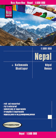
Nepal Road Map
Nepal on an indexed, waterproof and tear-resistant road map, ideal for locating the countrys numerous famous peaks, with topographic and tourist information, and enlargements for Kathmandu, Pokhara, and Chitwan regions, plus Bhaktapur. The map, published by Reise Know-How as part of their highly acclaimed World Mapping Project, is double-sided to provide the best balance between a good scale and a convenient size sheet.
The base map has altitude colouring with contours, spot heights and mountain passes. Names of main trekking areas are prominently highlighted in coloured boxes (e.g. Khumbu Himal, Mustang, Dolpa, etc.), as are names of national parks and conservation areas. The same system is used for numeous peaks - colour coding to indicate famous peaks (Everest, Annapurna, Kanchenjunga, Dhaulagiri, etc.), peaks requiring permit and fee payment (Island Peak, Mera, Peak, Naya Kanga, etc.) and permit and royalty free peaks. Classic trekking routes are marked, e.g. Jiri to Everest
- Product Number: RKH_NEP_20
- Reference Product Number: - None -
- ISBN: 9783831774395
- Date of Publication: 6/1/2020
- Folded Size: 10.24 inches high by 4.72 inches wide
- Unfolded (flat) Size: 27.56 inches high by 39.37 inches wide
- Map format: Folded
- Map type: Trade Maps - Road
- Geographical region: Nepal

