1904 Korea and Manchuria Map
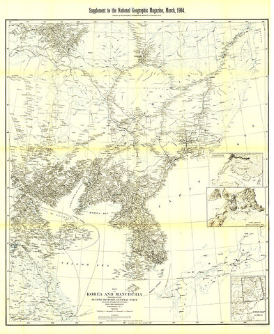
This historic black and white map of Korea and Manchuria contains exceptionally detailed inset maps of Port Arthur and Vladivostok. Published in March 1904 with the article Russian Development of Manchuria, this intricate cartographic work is a fine addition to any map collection.
- Product Number: PODHNG_KOR_04
- Reference Product Number: 2321354M
- ISBN: - None -
- Date of Publication: 6/1/1904
- Unfolded (flat) Size: 42.75 inches high by 35 inches wide
- Map format: Wall
- Map type: Trade Maps - Political
- Geographical region: Korea, North,Korea, South


![Buy map Korean Peninsula Classic [Tubed]](http://store.yellowmaps.com/cdn/shop/products/big_9e95c009-70d6-4048-8211-54847cbc7b54_600x600.jpg?v=1706689446)

