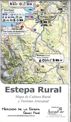
Estepa Rural hiking map
This hiking map from Pixmap features latitude/longitude and UTM grids (WGS84). This map uses a satellite image as the basis for the map, interpreting areas of snow, bare ground, vegetation and cultural features. Then, contour lines, numerous spot elevations, roads, camping huts, are laid over the image to produce the map.
- Product Number: PIX_ESR_
- Reference Product Number: 2294316M
- ISBN: - None -
- Folded Size: 8 inches high by 5 inches wide
- Unfolded (flat) Size: 23.5 inches high by 16.5 inches wide
- Map format: Folded
- Map type: Trade Maps - Hiking
- Geographical region: Argentina,Chile