
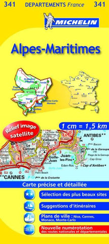
Alpes-Maritimes Road Map
This map is part of a very popular series by Frances world-famous Michelin Map Company. This map is ideal for both cycling and car touring. The map gives route numbers on nearly every road, thousands of tiny villages on backroads, distances between most road junctions, gradients on steep hills, all on a satellite image base map. The map uses symbols for ferries, airports, trains, sport and recreation facilities, sights, historic and prehistoric sites and monuments, lighthouses, oil and gas wells, telecommunication towers, factories, and much more. The legend is bilingual English/French, and the map is in French only.
- Product Number: M_341_ALPS_20
- Reference Product Number: - None -
- ISBN: 9782067202436
- Date of Publication: 6/1/2020
- Folded Size: 10 inches high by 4.5 inches wide
- Unfolded (flat) Size: 34.5 inches high by 38.5 inches wide
- Map format: Folded
- Map type: Trade Maps - Road
- Geographical region: France


