Lake Neusiedl, sailing map 1:50,000, wall map, flat
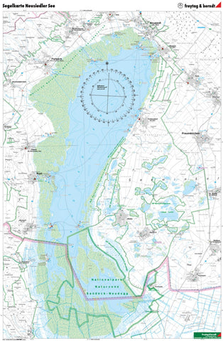
The Sailing Map of Lake Neusiedl 1: 50,000 is regularly revised and contains helpful general nautical information about the region as well as GPS coordinate points and an overview of all sailing clubs. The waterproof and hard -wearing paper defies wind and weather and is therefore perfect in addition to planning at home, but also perfectly to keep an overview on the boat. A hiking map of the region is on the back.Comes tubed.
- Product Number: FB_NEU_SAIL_WA_19
- Reference Product Number: - None -
- ISBN: 9783707917925
- Date of Publication: 9/20/2009
- Folded Size: 39.3 inches high by 27.51 inches wide
- Unfolded (flat) Size: 39.3 inches high by 27.51 inches wide
- Map format: Folded
- Map type: Trade Maps - Hiking
- Geographical region: Austria