Caribbean Map, US Virgin Islands Guide and Dive, laminated, 2009 by Frankos Maps Ltd.
This map is chock full of useful information, especially for the adventurous traveler. It a shaded relief, flat, laminated map.
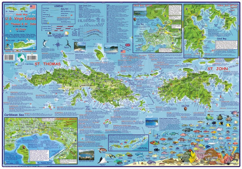
One side of the map is St. Thomas and St. John, with detail maps of Havensight, Coral Bay and Cruz Bay. The other side is St. Croix, with detail views of Frederiksted and Christiansted. There are small photos, fish identification, dive locations and more. This is the one map you need if you are planning travel to the U.S. Virgin Islands.
- Product Number: 2043011M
- Product Code: FM_USVI_Lam
- ISBN: 9781931494533
- Year of Publication: 2008
- Unfolded Size: 17.91 x 25.79 inches
- Map type: Flat Map
- Geographical region: Miscellaneous