Indian Country, Tubed by National Geographic Maps
Click to Zoom (high resolution)
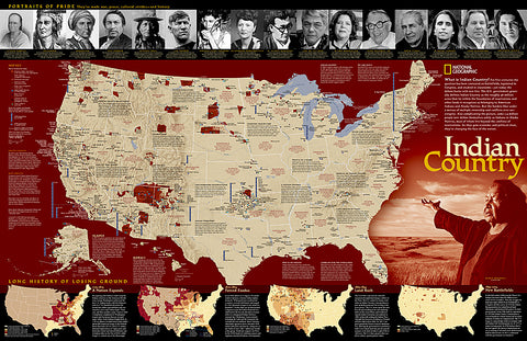
For five centuries, Indian territories have been contested on battlefields, legislated in Congress, and studied in classrooms. National Geographics map shows Indian reservations, tribal entities, trust lands, and locations of major festivals and pow-wows. Also includes photos and short biographies of notable Indians through history, and a series of four maps showing how Native American lands have lost territory from 1775 to the present. An excellent complement to our Indian Cultures of North America map.
The map is packaged in a 2-diameter clear plastic tube. The tube has a decorative label showing a thumbnail of the map with dimensions and other pertinent information.
- Product Number: 2033911M
- Product Code: NG_INDIAN_WA
- Publisher Product ID: RE0620315T
- ISBN: 9780792297239
- Year of Publication: 2011
- Unfolded Size: 23.23 x 35.83 inches
- Map type: Wall Map
- Geographical region: United States

