
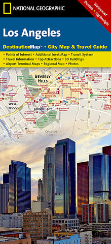
Los Angeles, California DestinationMap by National Geographic Maps
Click to Zoom (high resolution)
DestinationCity map of Los Angeles with 3D-style drawings of famous buildings and landmarks for easy orientation. Printed on waterproof, tear-resistant paper.
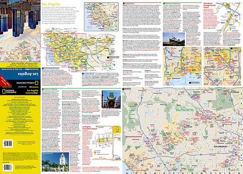
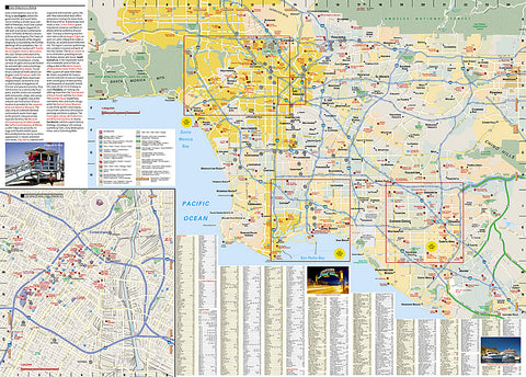
In addition to the easy-to-read map on the front, the back includes:
- Regional map
- Points of interest
- Inset maps of Downtown Los Angeles, Long Beach, Anaheim, and the Westside
- Los Angeles International Airport and John Wayne (Orange County) airport diagrams
- Multi-language legend.
Map Scale = 1:204,000
- Product Number: 2032654M
- Product Code: NG_DM_LOS_AN
- Publisher Product ID: DC01020316
- ISBN: 9781597750929
- Year of Publication: 2015
- Folded Size: 9.45 x 4.33 inches
- Unfolded Size: 14.96 x 20.47 inches
- Map type: Folded Map
- Geographical region: California


