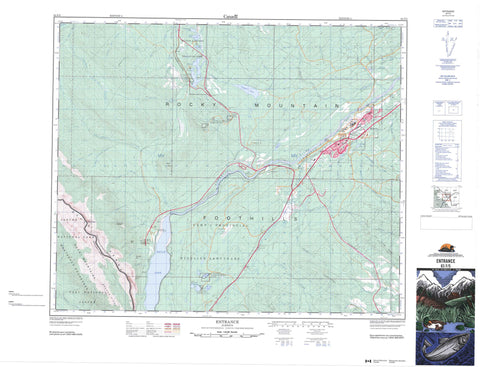
083F05 Entrance Canada topo map, 1:50,000 scale
083F05 Entrance NRCAN topographic map.
Includes UTM and GPS geographic coordinates (latitude and longitude). This 50k scale map is suitable for hiking, camping, and exploring, or you could frame it as a wall map.
Printed on-demand using high resolution, on heavy weight and acid free paper, or as an upgrade on a variety of synthetic materials.
Topos available on paper, Waterproof, Poly, or Tyvek. Usually shipping rolled, unless combined with other folded maps in one order.
- Product Number: NRCAN-083F05
- Parent Topo: TOPO-083F
- Map ID also known as: 083F05, 83F5, 83F05
- Unfolded Size: Approximately 26" high by 36" wide
- Weight (paper map): ca. 55 grams
- Map Type: POD NRCAN Topographic Map
- Map Scale: 1:50,000
- Geographical region: Alberta, Canada
Neighboring Maps:
All neighboring Canadian topo maps are available for sale online at 1:50,000 scale.
Purchase the smaller scale map covering this area: Topo-083F
Spatial coverage:
Topo map sheet 083F05 Entrance covers the following places:
- Blue Lake - Brûlé Lake - Cache Lake - Graveyard Lake - Jarvis Lake - Kia Nea Lake - Kinky Lake - Maxwell Lake - Peach Lake - Peppers Lake - Rat Lake - Thompson Lake - Wildhorse Lakes - Champ de manoeuvre Jarvis Lake - Jarvis Lake Training Area - Bedson Ridge - Black Cat Mountain - Boule Range - Boule Roche - Brûlé Hill - Cap Ridge - Errington Hill - High Divide Ridge - Moberly Hill - Montagnes Rocheuses - Mount Solomon - Rocky Mountain Foothills - Rocky Mountains - Seabolt Ridge - Municipal District of Yellowhead No. 94 - Yellowhead County - Improvement District No. 12 - Improvement District No. 14 - Improvement District No. 97 - Yellowhead Improvement District No. 14 - Entrance Provincial Park - Jasper National Park of Canada - Parc national du Canada Jasper - William A. Switzer Provincial Park - Anderson Creek - Athabasca River - Athabaska River - Brown Creek - Cache Percotte Creek - Canyon Creek - Caywood Creek - Centre Creek - Cold Creek - Fish Creek - Girvan Creek - Happy Creek - Hardisty Creek - Ice Water Creek - Jarvis Creek - Levi Creek - Marl Creek - Maskuta Creek - Moosehorn Creek - Oldhouse Creek - Orchard Creek - Paradise Creek - Peppers Creek - Powder Creek - Prine Creek - Rivière Athabasca - Scovil Creek - Seabolt Creek - Sheba Creek - Solomon Creek - Still Creek - Supply Creek - Teepee Creek - Tiecamp Creek - Twelve Mile Creek - West Solomon Creek - Whiskeyjack Creek - Wigwam Creek - Wildhay River - Winter Creek - Hinton - Brûlé - Brûlé Mines - Drinnan - Entrance - Hinton Collieries - Old Entrance - Solomon - Swan Landing - Drinnan

