
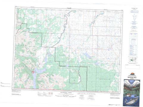
082H04 Waterton Lakes Canada topo map, 1:50,000 scale
082H04 Waterton Lakes NRCAN topographic map.
Includes UTM and GPS geographic coordinates (latitude and longitude). This 50k scale map is suitable for hiking, camping, and exploring, or you could frame it as a wall map.
Printed on-demand using high resolution, on heavy weight and acid free paper, or as an upgrade on a variety of synthetic materials.
Topos available on paper, Waterproof, Poly, or Tyvek. Usually shipping rolled, unless combined with other folded maps in one order.
- Product Number: NRCAN-082H04
- Parent Topo: TOPO-082H
- Map ID also known as: 082H04, 82H4, 82H04
- Unfolded Size: Approximately 26" high by 36" wide
- Weight (paper map): ca. 55 grams
- Map Type: POD NRCAN Topographic Map
- Map Scale: 1:50,000
- Geographical region: Alberta, Canada
Neighboring Maps:
All neighboring Canadian topo maps are available for sale online at 1:50,000 scale.
Purchase the smaller scale map covering this area: Topo-082H
Spatial coverage:
Topo map sheet 082H04 Waterton Lakes covers the following places:
- Emerald Bay - Beebe Flats - Bosporus - Dardanelles - Bears Hump - Cameron Falls - Crypt Falls - Hell-Roaring Falls - Lower Bertha Falls - Sofa Creek Falls - Swirling Mist Falls - Twin Falls - Upper Bertha Falls - Blood 148A - Alderson Lake - Beaverdam Lake - Bertha Lake - Carthew Lakes - Crandell Lake - Crypt Lake - Deer Lake - Giants Mirror - Horseshoe Lake - Indian Springs - Kesler Lake - Kootenai Lake - Linnet Lake - Lonesome Lake - Loon Lake - Lower Waterton Lake - Maskinonge Lake - Middle Waterton Lake - Paine Lake - Payne Lake - Upper Waterton Lake - Waterton Lake - Waterton Lakes - Beazer Ridge - Bellevue Hill - Bertha Peak - Birdseye Butte - Border Ranges - Buchanan Peak - Buchanan Ridge - Cameron Mountain - Cameronian Mountain - Clark Range - Cloudy Ridge - Indian Springs Ridge - Lakeview Ridge - Mokowan Butte - Mount Alderson - Mount Boswell - Mount Carthew - Mount Crandell - Mount Dungarvan - Mount Galwey - Mount Richards - Pine Ridge - Rocky Mountain Foothills - Ruby Ridge - Sofa Mountain - Trivett Ridge - Vimy Peak - Vimy Ridge - Wilson Range - Cardston County - Municipal District of Cardston No. 6 - Municipal District of Pincher Creek No. 9 - Improvement District No. 4 - Improvement District of Ranchland No. 6 - First Oil Well in Western Canada National Historic Site - Lieu historique national du Canada du Premier-Puits-de-Pétrole-de-l'Ouest-Canadien - Parc national du Canada des Lacs-Waterton - Site du patrimoine mondial du Parc international de la paix Waterton-Glacier - Waterton Lakes National Park of Canada - Waterton-Glacier International Peace Park - Waterton-Glacier International Peace Park World Heritage Site - Beebee Flats - Alderson Creek - Belly River - Bertha Brook - Bertha Creek - Blakiston Brook - Blakiston Creek - Cameron Brook - Cameron Creek - Carthew Creek - Coppermine Creek - Cottonwood Creek - Crooked Creek - Dungarvan Creek - Galwey Brook - Galwey Creek - Hell-Roaring Creek - Lee Creek - Lineham Brook - Lineham Creek - Lost Horse Creek - Mami Creek - North Belly River - Pass Creek (Blakiston Brook) - Ruby Creek - Sofa Creek - Tough Creek - Waterton River - Yarrow Creek - Caldwell - Chief Mountain - Mountain View - Parkbend - Waterton Park - Blind Canyon - Bullhorn Coulee - Horseshoe Basin - Oil Basin


