
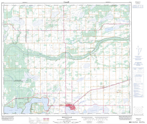
073L07 Bonnyville Canada topo map, 1:50,000 scale
073L07 Bonnyville NRCAN topographic map.
Includes UTM and GPS geographic coordinates (latitude and longitude). This 50k scale map is suitable for hiking, camping, and exploring, or you could frame it as a wall map.
Printed on-demand using high resolution, on heavy weight and acid free paper, or as an upgrade on a variety of synthetic materials.
Topos available on paper, Waterproof, Poly, or Tyvek. Usually shipping rolled, unless combined with other folded maps in one order.
- Product Number: NRCAN-073L07
- Parent Topo: TOPO-073L
- Map ID also known as: 073L07, 73L7, 73L07
- Unfolded Size: Approximately 26" high by 36" wide
- Weight (paper map): ca. 55 grams
- Map Type: POD NRCAN Topographic Map
- Map Scale: 1:50,000
- Geographical region: Alberta, Canada
Neighboring Maps:
All neighboring Canadian topo maps are available for sale online at 1:50,000 scale.
Purchase the smaller scale map covering this area: Topo-073L
Spatial coverage:
Topo map sheet 073L07 Bonnyville covers the following places:
- Barreyre Lake - Charlotte Lake - Chatwin Lake - Crane Lake - Edward Lake - Forsyth Lake - Harold Lake - Jessie Lake - Liza Lake - Manatokan Lake - Moose Lake - Osborne Lake - Stebbing Lake - Municipal District of Bonnyville No. 87 - Municipal District of Bonnyville No. 87 - Moose Lake Provincial Park - Beaver River - Jackfish Creek - Manatokan Creek - Mooselake River - Muriel Creek - Osborne Creek - Bonnyville - Anshaw - Big Meadow - Dirleton - Durlingville - Fort Kent - Happy Hollow - Iron River - La Corey - Lessard - Pelican Narrows


