
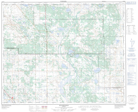
073D10 Hughenden Canada topo map, 1:50,000 scale
073D10 Hughenden NRCAN topographic map.
Includes UTM and GPS geographic coordinates (latitude and longitude). This 50k scale map is suitable for hiking, camping, and exploring, or you could frame it as a wall map.
Printed on-demand using high resolution, on heavy weight and acid free paper, or as an upgrade on a variety of synthetic materials.
Topos available on paper, Waterproof, Poly, or Tyvek. Usually shipping rolled, unless combined with other folded maps in one order.
- Product Number: NRCAN-073D10
- Parent Topo: TOPO-073D
- Map ID also known as: 073D10, 73D10
- Unfolded Size: Approximately 26" high by 36" wide
- Weight (paper map): ca. 55 grams
- Map Type: POD NRCAN Topographic Map
- Map Scale: 1:50,000
- Geographical region: Alberta, Canada
Neighboring Maps:
All neighboring Canadian topo maps are available for sale online at 1:50,000 scale.
Purchase the smaller scale map covering this area: Topo-073D
Spatial coverage:
Topo map sheet 073D10 Hughenden covers the following places:
- Arm Lake - Border Lake - Cattalo Lake - Cotton Lake - David Lake - Dixon Lake - Elk Butte Lake - Gat Lake - Hughenden Lake - Jamieson Lake - McCafferty Lake - Normandin Lake - Peterson Lake - Rough Lake - Slow Lake - Swift Lake - Tit Willow Lake - Wallaby Lake - Williamson Lake - Willow Lake - Yak Lake - Yak Lakes - Champ de manoeuvre régional Wainwright - Wainwright Regional Training Area - Elk Butte - Gunner Hill - Highland Heights - Infantry Hill - Little Elk Buttes - Observation Hill - Patricia Hill - Rifle Ridge - Signal Hill - Municipal District of Provost No. 52 - Municipal District of Wainwright No. 61 - Ribstone Creek - Cattalo Bridge - Cattalo Trail - Half-Breed Ford - Strathcona Trail - Buffalo View - Park Farm - Hay Marsh - Hughenden


