
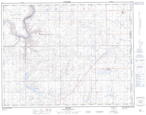
072L08 Hilda Canada topo map, 1:50,000 scale
072L08 Hilda NRCAN topographic map.
Includes UTM and GPS geographic coordinates (latitude and longitude). This 50k scale map is suitable for hiking, camping, and exploring, or you could frame it as a wall map.
Printed on-demand using high resolution, on heavy weight and acid free paper, or as an upgrade on a variety of synthetic materials.
Topos available on paper, Waterproof, Poly, or Tyvek. Usually shipping rolled, unless combined with other folded maps in one order.
- Product Number: NRCAN-072L08
- Parent Topo: TOPO-072L
- Map ID also known as: 072L08, 72L8, 72L08
- Unfolded Size: Approximately 26" high by 36" wide
- Weight (paper map): ca. 55 grams
- Map Type: POD NRCAN Topographic Map
- Map Scale: 1:50,000
- Geographical region: Alberta, Canada
Neighboring Maps:
All neighboring Canadian topo maps are available for sale online at 1:50,000 scale.
Purchase the smaller scale map covering this area: Topo-072L
Spatial coverage:
Topo map sheet 072L08 Hilda covers the following places:
- Rapid Narrows - Greenan Lake - Red Deer Lake - Schuler Lake - Base des Forces canadiennes Suffield - Canadian Forces Base Suffield - Champ de manoeuvre Suffield - Suffield Training Area - Municipal District of Cypress - Municipal District of Cypress No. 1 - Canadian Forces Base Suffield National Wildlife Area - Réserve nationale de faune de la Base des Forces canadiennes Suffield - Rivière Saskatchewan Sud - South Saskatchewan River - Hilda - Pivot - Roseglen - Schuler - Bull Springs Coulée - White Rock Coulée


