
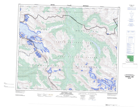
083E06 Twintree Lake Canada topo map, 1:50,000 scale
083E06 Twintree Lake NRCAN topographic map.
Includes UTM and GPS geographic coordinates (latitude and longitude). This 50k scale map is suitable for hiking, camping, and exploring, or you could frame it as a wall map.
Printed on-demand using high resolution, on heavy weight and acid free paper, or as an upgrade on a variety of synthetic materials.
Topos available on paper, Waterproof, Poly, or Tyvek. Usually shipping rolled, unless combined with other folded maps in one order.
- Product Number: NRCAN-083E06
- Parent Topo: TOPO-083E
- Map ID also known as: 083E06, 83E6, 83E06
- Unfolded Size: Approximately 26" high by 36" wide
- Weight (paper map): ca. 55 grams
- Map Type: POD NRCAN Topographic Map
- Map Scale: 1:50,000
- Geographical region: Alberta, Canada
Neighboring Maps:
All neighboring Canadian topo maps are available for sale online at 1:50,000 scale.
Purchase the smaller scale map covering this area: Topo-083E
Spatial coverage:
Topo map sheet 083E06 Twintree Lake covers the following places:
- Chown Glacier - Resthaven Icefield - Azure Lake - Blue Lake - Twintree Lake - Barricade Mountain - Calumet Peak - Calumet Ridge - Montagnes Rocheuses - Montagnes Rocheuses - Mount Barra - Mount Bess - Mount Bess - Mount Chown - Mount Jessie - Park Ranges - Rocky Mountains - Rocky Mountains - Saghali Mountain - Swoda Mountain - Twintree Mountain - Whiteshield Mountain - Whiteshield Mountain - Wolverine Mountain - Cariboo Regional District - Regional District of Fraser-Fort George - Improvement District No. 12 - Improvement District No. 25 - Yellowhead Improvement District No. 14 - Jasper National Park of Canada - Mount Robson Park - Parc national du Canada Jasper - Willmore Wilderness Provincial Park - Calumet Creek - Carcajou Creek - Chown Creek - Desolation Creek - Hardscrabble Creek - Holmes River - Jackpine Creek - Jackpine River - Moose Wallow Creek - Morris Creek - Rockslide Creek - Short Creek - Smoky River - Swoda Creek - Twintree Creek - West Sulphur Trail - Bess Pass - Bess Pass - Jackpine Pass - Jackpine Pass


