
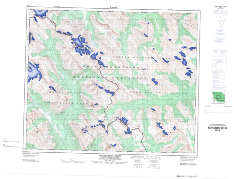
083E02 Resplendent Creek Canada topo map, 1:50,000 scale
083E02 Resplendent Creek NRCAN topographic map.
Includes UTM and GPS geographic coordinates (latitude and longitude). This 50k scale map is suitable for hiking, camping, and exploring, or you could frame it as a wall map.
Printed on-demand using high resolution, on heavy weight and acid free paper, or as an upgrade on a variety of synthetic materials.
Topos available on paper, Waterproof, Poly, or Tyvek. Usually shipping rolled, unless combined with other folded maps in one order.
- Product Number: NRCAN-083E02
- Parent Topo: TOPO-083E
- Map ID also known as: 083E02, 83E2, 83E02
- Unfolded Size: Approximately 26" high by 36" wide
- Weight (paper map): ca. 55 grams
- Map Type: POD NRCAN Topographic Map
- Map Scale: 1:50,000
- Geographical region: Alberta, Canada
Neighboring Maps:
All neighboring Canadian topo maps are available for sale online at 1:50,000 scale.
Purchase the smaller scale map covering this area: Topo-083E
Spatial coverage:
Topo map sheet 083E02 Resplendent Creek covers the following places:
- Arctomys Cave - North Passage - Arctomys Falls - Reef Glaciers - Reef Icefield - Reef Icefield - Steppe Glacier - Arctomys Lake - Comoy Lake - Idalene Lake - Lazuli Lake - Miette Lake - McNaughton Ridge - Montagnes Rocheuses - Montagnes Rocheuses - Mount Beaupré - Mount Machray - Mount Machray - Mount Mahood - Mount McCord - Mount McCord - Mount McNaughton - Mount Moren - Park Ranges - Rainbow Range - Razor Peak - Rocky Mountains - Rocky Mountains - Salient Mountain - Salient Mountain - The Colonel - The Ranee - Treadmill Ridge - Treadmill Ridge - Trio Mountain - Upright Mountain - Upright Mountain - Victoria Cross Range - Victoria Cross Ranges - Cariboo Regional District - Regional District of Fraser-Fort George - Improvement District No. 12 - Jasper National Park of Canada - Parc national du Canada Jasper - Arctomys Creek - Campion Creek - Colonel Creek - Derr Creek - Grant Brook - McNaughton Creek - Miette River - Moose River - Resplendent Creek - Snake Indian River - Snaring River - Steppe Creek - Upright Creek - Woodley Creek - Arctomys Valley - Centre Pass - Centre Pass - Colonel Pass - Colonel Pass - Grant Pass - Grant Pass - Miette Pass - Miette Pass - North Pass - North Pass - Red Pass - Upright Pass - Upright Pass


