
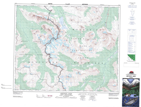
083D09 Amethyst Lakes Canada topo map, 1:50,000 scale
083D09 Amethyst Lakes NRCAN topographic map.
Includes UTM and GPS geographic coordinates (latitude and longitude). This 50k scale map is suitable for hiking, camping, and exploring, or you could frame it as a wall map.
Printed on-demand using high resolution, on heavy weight and acid free paper, or as an upgrade on a variety of synthetic materials.
Topos available on paper, Waterproof, Poly, or Tyvek. Usually shipping rolled, unless combined with other folded maps in one order.
- Product Number: NRCAN-083D09
- Parent Topo: TOPO-083D
- Map ID also known as: 083D09, 83D9, 83D09
- Unfolded Size: Approximately 26" high by 36" wide
- Weight (paper map): ca. 55 grams
- Map Type: POD NRCAN Topographic Map
- Map Scale: 1:50,000
- Geographical region: Alberta, Canada
Neighboring Maps:
All neighboring Canadian topo maps are available for sale online at 1:50,000 scale.
Purchase the smaller scale map covering this area: Topo-083D
Spatial coverage:
Topo map sheet 083D09 Amethyst Lakes covers the following places:
- The Ramparts - Angel Glacier - Barbican Glacier - Bennington Glacier - Casemate Glacier - Eremite Glacier - Fraser Glacier - Gateway Glacier - Mastodon Glacier - Scarp Glacier - Simon Glacier - Amethyst Lakes - Arrowhead Lake - Beacon Lake - Beryl Lake - Buttress Lake - Cavell Lake - Chalk Lake - Chrome Lake - Icefall Lake - Jade Lake - Moat Lake - Alcove Mountain - Angle Peak - Aquila Mountain - Barbican Peak - Bastion Peak - Bastion Peak - Beacon Peak - Bennington Peak - Bennington Peak - Blackhorn Peak - Blackrock Mountain - Blackrock Mountain - Brûlé Hill - Caniche Peak - Casemate Mountain - Chak Peak - Chevron Mountain - Clitheroe Mountain - Drawbridge Peak - Drawbridge Peak - Dungeon Peak - Dungeon Peak - Elephas Mountain - Elephas Mountain - Eremite Mountain - Franchère Peak - Gateway Peak - Goodair Peak - Lectern Peak - Mastodon Mountain - Mastodon Mountain - Mastodon Peak - McDonell Peak - McDonell Peak - Minotaur Peak - Montagnes Rocheuses - Montagnes Rocheuses - Mount Cavell - Mount Clitheroe - Mount Edith Cavell - Mount Erebus - Mount Fraser - Mount Fraser - Mount Geikie - Mount Maccarib - Needle Peak - Oldhorn Mountain - Outpost Peak - Paragon Peak - Paragon Peak - Parapet Peak - Parapet Peak - Park Ranges - Portcullis Peak - Postern Mountain - Redoubt Peak - Redoubt Peak - Reunion Peak - Reunion Peak - Rocky Mountains - Rocky Mountains - Rufus Peak - Scarp Mountain - Scarp Mountain - Simon Peak - Simon Peak - Surprise Point - The Cube Ridge - The Ramparts - Throne Mountain - Thunderbolt Peak - Tonquin Hill - Tonquin Hill - Tonquin Ridge - Trident Range - Turret Mountain - Vertex Peak - Whitecrow Mountain - Whitecrow Mountain - Cariboo Regional District - Regional District of Fraser-Fort George - Improvement District No. 12 - Jasper National Park of Canada - Mount Robson Park - Parc national du Canada Jasper - Astoria River - Campus Creek - Cavell Creek - Divergence Creek - Eremite Creek - Fleuve Fraser - Fraser River - Geikie Creek - Geikie Creek - Maccarib Creek - Middle Whirlpool River - Moat Creek - Penstock Creek - Portal Creek - Ross Cox Creek - Simon Creek - Tonquin Creek - Verdant Creek - Vista Creek - Whirlpool River - Astoria Pass - Campus Pass - Fraser Pass - Maccarib Pass - Moat Pass - Moat Pass - The Portal - Tonquin Pass - Tonquin Pass - Tonquin Valley - Verdant Pass - Vista Pass - Vista Pass


