
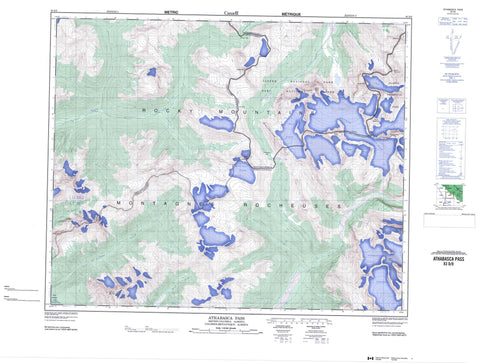
083D08 Athabasca Pass Canada topo map, 1:50,000 scale
083D08 Athabasca Pass NRCAN topographic map.
Includes UTM and GPS geographic coordinates (latitude and longitude). This 50k scale map is suitable for hiking, camping, and exploring, or you could frame it as a wall map.
Printed on-demand using high resolution, on heavy weight and acid free paper, or as an upgrade on a variety of synthetic materials.
Topos available on paper, Waterproof, Poly, or Tyvek. Usually shipping rolled, unless combined with other folded maps in one order.
- Product Number: NRCAN-083D08
- Parent Topo: TOPO-083D
- Map ID also known as: 083D08, 83D8, 83D08
- Unfolded Size: Approximately 26" high by 36" wide
- Weight (paper map): ca. 55 grams
- Map Type: POD NRCAN Topographic Map
- Map Scale: 1:50,000
- Geographical region: Alberta, Canada
Neighboring Maps:
All neighboring Canadian topo maps are available for sale online at 1:50,000 scale.
Purchase the smaller scale map covering this area: Topo-083D
Spatial coverage:
Topo map sheet 083D08 Athabasca Pass covers the following places:
- Alnus Glaciers - Clemenceau Icefield - Hooker Glacier - Hooker Icefield - Hooker Icefield - Kane Glacier - Kane Glacier - Mount Brown Icefield - Mount Brown Icefield - North Alnus Glacier - Scott Glacier - Serenity Glacier - South Alnus Glacier - Committee Punch Bowl - Committee Punch Bowl - Kinbasket Lake - Alnus Peak - Alnus Peak - Bras Croche - Dunkirk Mountain - Mallard Peak - Mallard Peak - McGillivray Ridge - McGillivray Ridge - Montagnes Rocheuses - Montagnes Rocheuses - Mount Brown - Mount Brown - Mount Bruce - Mount Ermatinger - Mount Ermatinger - Mount Evans - Mount Farrar - Mount Hooker - Mount Hooker - Mount Kane - Mount Mallory - Mount Oates - Mount Oates - Mount Ross Cox - Mount Ross Cox - Mount Scott - Mount Scott - Park Ranges - Rocky Mountains - Rocky Mountains - Serenity Mountain - Serenity Mountain - Cariboo Regional District - Columbia-Shuswap Regional District - Regional District of Fraser-Fort George - Improvement District No. 12 - Athabasca Pass National Historic Site of Canada - Hamber Park - Jasper National Park of Canada - Lieu historique national du Canada du Col-Athabasca - Parc national du Canada Jasper - Baker Creek - Dawson Creek - East Iroquois Creek - Harvey Creek - Hugh Allan Creek - Iroquois Creek - Jeffrey Creek - Middle Whirlpool River - Molson Creek - Pacific Creek - Ross Cox Creek - Scott Creek - Whirlpool River - Wood River - Canoe Reach - Athabasca Pass - Athabasca Pass - Canoe Pass - Canoe Pass - Whirlpool Pass - Whirlpool Pass


