
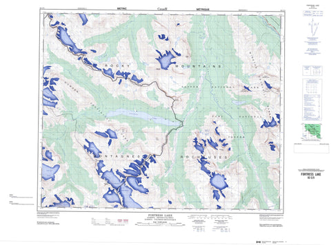
083C05 Fortress Lake Canada topo map, 1:50,000 scale
083C05 Fortress Lake NRCAN topographic map.
Includes UTM and GPS geographic coordinates (latitude and longitude). This 50k scale map is suitable for hiking, camping, and exploring, or you could frame it as a wall map.
Printed on-demand using high resolution, on heavy weight and acid free paper, or as an upgrade on a variety of synthetic materials.
Topos available on paper, Waterproof, Poly, or Tyvek. Usually shipping rolled, unless combined with other folded maps in one order.
- Product Number: NRCAN-083C05
- Parent Topo: TOPO-083C
- Map ID also known as: 083C05, 83C5, 83C05
- Unfolded Size: Approximately 26" high by 36" wide
- Weight (paper map): ca. 55 grams
- Map Type: POD NRCAN Topographic Map
- Map Scale: 1:50,000
- Geographical region: Alberta, Canada
Neighboring Maps:
All neighboring Canadian topo maps are available for sale online at 1:50,000 scale.
Purchase the smaller scale map covering this area: Topo-083C
Spatial coverage:
Topo map sheet 083C05 Fortress Lake covers the following places:
- Alnus Glaciers - Chaba Icefield - Chaba Icefield - Clemenceau Glacier - Clemenceau Icefield - Duplicate Glacier - Ghost Glacier - Gong Glacier - Misty Glacier - North Alnus Glacier - Serenity Glacier - South Alnus Glacier - Dragon Lake - Fortress Lake - Gong Lake - Blackfriar Peak - Blackfriars Peak - Blackmonks Mountain - Brouillard Mountain - Catacombs Mountain - Chisel Peak - Dais Mountain - Divergence Peak - Divergence Peak - Dragon Peak - Endless Chain Ridge - Fortress Mountain - Fortress Mountain - Ghost Mountain - Lick Peak - Lick Peak - Listening Mountain - Mitchell Group - Montagnes Rocheuses - Montagnes Rocheuses - Mount Adam Joachim - Mount Alberta - Mount Clemenceau - Mount Confederation - Mount Mitchell - Mount Morden Long - Mount Palmer - Mount Quincy - Mount Quincy - Mount Sadleir - Mountain Armchair - Rocky Mountains - Rocky Mountains - Thorington Tower - Winston Churchill Range - Younghusband Ridge - Columbia-Shuswap Regional District - Improvement District No. 12 - Hamber Park - Jasper National Park of Canada - Parc national du Canada Jasper - Alnus Creek - Athabasca River - Athabaska River - Catacombs Creek - Chaba River - Chisel Creek - Clemenceau Creek - Dragon Creek - Fortress Creek - Ghost Creek - Habel Creek - Lick Creek - Lynx Creek - Quincy Creek - Rivière Athabasca - Serenity Creek - Sunwapta River - Warwick Creek - Wood River - Fortress Pass - Fortress Pass


