
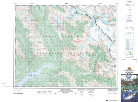
082N14 Rostrum Peak Canada topo map, 1:50,000 scale
082N14 Rostrum Peak NRCAN topographic map.
Includes UTM and GPS geographic coordinates (latitude and longitude). This 50k scale map is suitable for hiking, camping, and exploring, or you could frame it as a wall map.
Printed on-demand using high resolution, on heavy weight and acid free paper, or as an upgrade on a variety of synthetic materials.
Topos available on paper, Waterproof, Poly, or Tyvek. Usually shipping rolled, unless combined with other folded maps in one order.
- Product Number: NRCAN-082N14
- Parent Topo: TOPO-082N
- Map ID also known as: 082N14, 82N14
- Unfolded Size: Approximately 26" high by 36" wide
- Weight (paper map): ca. 55 grams
- Map Type: POD NRCAN Topographic Map
- Map Scale: 1:50,000
- Geographical region: Alberta, Canada
Neighboring Maps:
All neighboring Canadian topo maps are available for sale online at 1:50,000 scale.
Purchase the smaller scale map covering this area: Topo-082N
Spatial coverage:
Topo map sheet 082N14 Rostrum Peak covers the following places:
- Bush Arm - Prattle Bay - Alexandra Glaciers - East Lyell Glacier - East Rice Glacier - East Rice Glacier - Lyell Icefield - Lyell Icefield - Lyell Snowfield - Lyell Snowfield - Mons Icefield - Mons Icefield - North Rice Glacier - South Rice Glaciers - Southeast Lyell Glacier - Southeast Lyell Glacier - Southwest Lyell Glaciers - West Alexandra Glacier - Arras Mountain - Blackwater Range - Breaker Mountain - Bush Mountain - Bush Peak - Christian Peak - Christian Peak - Cockscomb Mountain - Corsair Mountain - Division Mountain - Division Mountain - Douai Mountain - Douai Mountain - Duplex Mountain - Edward Peak - Ego Mountain - Ernest Peak - Ernest Peak - Farbus Mountain - Farbus Mountain - Fresnoy Mountain - Fresnoy Mountain - Goat Peak - Hooge Mountain - Icefall Peak - Kemmel Mountain - La Clytte Mountain - Ladylove Mountain - Lens Mountain - Mons Peak - Mons Peak - Montagnes Rocheuses - Montagnes Rocheuses - Mount Alexandra - Mount Alexandra - Mount Lyell - Mount Lyell - Mount Whiterose - Oppy Mountain - Oppy Mountain - Privateer Mountain - Rocky Mountains - Rocky Mountains - Rostrum Peak - Rudolph Peak - St. Julien Mountain - St. Julien Mountain - Valenciennes Mountain - Vertebrae Ridge - Walter Peak - Walter Peak - Whiterose Mountain - Zillebeke Mountain - Columbia-Shuswap Regional District - Regional District of Kootenay-Boundary - Improvement District No. 9 - Banff National Park of Canada - Parc national du Canada Banff - Arctomys Creek - Bush River - Chatter Creek - Goodfellow Creek - Icefall Brook - Lyell Creek - Mons Creek - Navy Creek - Prattle Creek - Ridges Creek - South Rice Brook - Valenciennes River - Columbia Reach


