
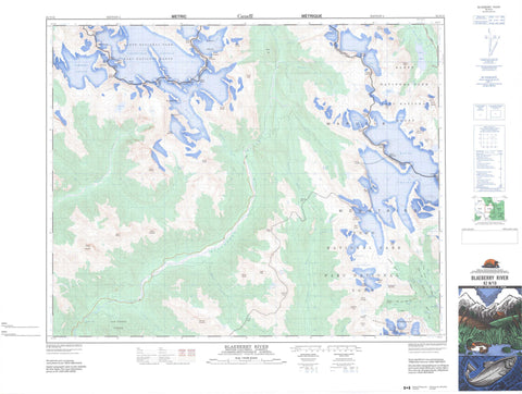
082N10 Blaeberry River Canada topo map, 1:50,000 scale
082N10 Blaeberry River NRCAN topographic map.
Includes UTM and GPS geographic coordinates (latitude and longitude). This 50k scale map is suitable for hiking, camping, and exploring, or you could frame it as a wall map.
Printed on-demand using high resolution, on heavy weight and acid free paper, or as an upgrade on a variety of synthetic materials.
Topos available on paper, Waterproof, Poly, or Tyvek. Usually shipping rolled, unless combined with other folded maps in one order.
- Product Number: NRCAN-082N10
- Parent Topo: TOPO-082N
- Map ID also known as: 082N10, 82N10
- Unfolded Size: Approximately 26" high by 36" wide
- Weight (paper map): ca. 55 grams
- Map Type: POD NRCAN Topographic Map
- Map Scale: 1:50,000
- Geographical region: Alberta, Canada
Neighboring Maps:
All neighboring Canadian topo maps are available for sale online at 1:50,000 scale.
Purchase the smaller scale map covering this area: Topo-082N
Spatial coverage:
Topo map sheet 082N10 Blaeberry River covers the following places:
- Amiskwi Falls - Blaeberry Falls - Diableret Falls - Fall of the Waves - Laughing Falls - Twin Falls - Ayesha Glacier - Baker Glacier - Barbette Glacier - Bow Glacier - Cairnes Glacier - Campbell Glacier - Campbell Icefield - Capricorn Glacier - Delta Glacier - Dragonback Glacier - Emerald Glacier - Freshfield Icefield - Glacier des Poilus - Lambe Glacier - McArthur Glacier - Mummery Glacier - Parapet Glacier - Parapet Glacier - Peyto Glacier - Waitabit Glacier - Wapta Glacier - Wapta Icefield - Wapta Icefield - Yoho Glacier - Amiskwi Lake - Caldron Lake - Frigid Lake - Kiwetinok Lake - Lake Celeste - Lake Duchesnay - Lateral Lake - Marpole Lake - Peyto Lake - Twin Lakes - Waitabit Lake - Amiskwi Peak - Arete Peak - Ayesha Peak - Barbette Mountain - Barbette Mountain - Barnard Dent Group - Barnard Dent Group - Blackwater Range - Caldron Peak - Conway Group - Conway Group - Doubt Hill - Fisher Peak - Gilgit Mountain - Gilgit Mountain - Hagen Peak - Isolated Peak - Kiwetinok Peak - Kiwetinok Ridge - McArthur Mountain - Mistaya Mountain - Mistaya Mountain - Mont des Poilus - Montagnes Rocheuses - Montagnes Rocheuses - Mount Baker - Mount Baker - Mount Barlow - Mount Barlow - Mount Barnard - Mount Bulyea - Mount Bulyea - Mount Cairnes - Mount Collie - Mount de Margerie - Mount Freshfield - Mount Freshfield - Mount Gilgit - Mount Gordon - Mount Habel - Mount Habel - Mount Helmer - Mount Helmer - Mount Jimmy Simpson - Mount Keays - Mount Kerr - Mount Lambe - Mount Lambe - Mount Laussedat - Mount Lotosky - Mount Low - Mount Low - Mount Mather - Mount McArthur - Mount Mummery - Mount Patterson - Mount Pilkington - Mount Pilkington - Mount Poland - Mount Pollinger - Mount Prior - Mount Prior - Mount Rhondda - Mount Rhondda - Mount Sheppard - Mount Termier - Mount Thompson - Mount Trutch - Mount Trutch - Mount Walker - Mount Whiteaves - Mount Whiteaves - Mummery Group - Nanga Parbat Mountain - Nanga Parbat Mountain - Ogre Peak - Peyto Peak - Portal Peak - President Range - Prior Peak - Prior Peak - Rocky Mountains - Rocky Mountains - Sea Lion Mountain - Sealion Mountain - Solitaire Mountain - St. Nicholas Peak - St. Nicholas Peak - The President - The Secretary-Treasurer - The Vice President - Thompson Mountain - Trapper Peak - Trapper Peak - Trutch Mountain - Van Horne Range - Waitabit Peak - Waitabit Peak - Waputik Mountains - Waputik Mountains - Whaleback Mountain - Yoho Peak - Columbia-Shuswap Regional District - Regional District of Kootenay-Boundary - Improvement District No. 9 - Banff National Park of Canada - Lieu historique national du Canada du Salon-de-Thé-des-Chutes-Twin - Parc national du Canada Banff - Parc national du Canada Yoho - Twin Falls Tea House National Historic Site of Canada - Yoho National Park of Canada - Amiskwi River - Blaeberry River - Bluewater Creek - Breaker Creek - Caldron Creek - Collie Creek - Delta Creek - Ensign Creek - Fairy Creek - Kit Creek - Kiwetinok River - Little Yoho River - Martin Creek - Mistaya River - Mummery Creek - Otto Creek - Parapet Creek - Peyto Creek - Split Creek - Twin Falls Creek - Waitabit Creek - Waves Creek - Wildcat Creek - Yoho River - Amiskwi Pass - Kiwetinok Pass - Kiwetinok Valley - Otto Pass - President Pass - Waterfall Valley - Yoho Valley


