
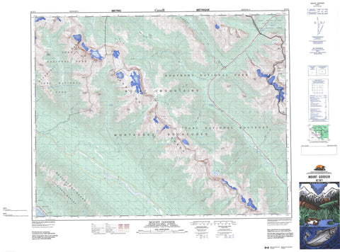
082N01 Mount Goodsir Canada topo map, 1:50,000 scale
082N01 Mount Goodsir NRCAN topographic map.
Includes UTM and GPS geographic coordinates (latitude and longitude). This 50k scale map is suitable for hiking, camping, and exploring, or you could frame it as a wall map.
Printed on-demand using high resolution, on heavy weight and acid free paper, or as an upgrade on a variety of synthetic materials.
Topos available on paper, Waterproof, Poly, or Tyvek. Usually shipping rolled, unless combined with other folded maps in one order.
- Product Number: NRCAN-082N01
- Parent Topo: TOPO-082N
- Map ID also known as: 082N01, 82N1, 82N01
- Unfolded Size: Approximately 26" high by 36" wide
- Weight (paper map): ca. 55 grams
- Map Type: POD NRCAN Topographic Map
- Map Scale: 1:50,000
- Geographical region: Alberta, Canada
Neighboring Maps:
All neighboring Canadian topo maps are available for sale online at 1:50,000 scale.
Purchase the smaller scale map covering this area: Topo-082N
Spatial coverage:
Topo map sheet 082N01 Mount Goodsir covers the following places:
- Rockwall - Goodsir Glacier - Hanbury Glacier - Sharp Glacier - Tumbling Glacier - Washmawapta Glacier - Washmawapta Glacier - Washmawapta Icefield - West Washmawapta Glacier - Altrude Lakes - Dainard Lake - Floe Lake - High Lake - Vista Lake - Aquila Mountain - Ball Range - Ball Range - Beaverfoot Range - Boom Mountain - Buttress Peak - Castle Mountain - Clawson Peak - Duncan Ranges - Foster Peak - Garnet Mountain - Hanbury Peak - Hawk Ridge - Helmet Mountain - Isabelle Peak - Isabelle Peak - Kootenay Ranges - Limestone Peak - Manganese Mountain - Montagnes Rocheuses - Montagnes Rocheuses - Mount Anstey - Mount Ball - Mount Ball - Mount Drysdale - Mount Goodsir - Mount Gray - Mount Haffner - Mount Mollison - Mount Sharp - Mount Verendrye - Mount Whymper - North Tower - Numa Mountain - Ottertail Range - Rocky Mountains - Rocky Mountains - Sentry Peak - Sharp Mountain - South Tower - Stanley Peak - Storm Mountain - Striped Mountain - Vermilion Peak - Vermilion Range - Zinc Mountain - Columbia-Shuswap Regional District - Regional District of East Kootenay - Regional District of Kootenay-Boundary - Improvement District No. 9 - Banff National Park of Canada - Canadian Rocky Mountain Parks World Heritage Site - Kootenay National Park of Canada - Parc national du Canada Banff - Parc national du Canada Kootenay - Parc national du Canada Yoho - Site du patrimoine mondial des Parcs des montagnes Rocheuses canadiennes - Yoho National Park of Canada - Altrude Creek - Beaverfoot River - Boom Creek - Clawson Creek - Columbia River - Dainard Creek - De Grazie Creek - Fleuve Columbia - Floe Creek - Garnet Creek - Goodsir Creek - Haffner Creek - Hatch Creek - Hawk Creek - Helmet Creek - Hot Creek - Ice River - Kootenay River - Martins Creek - Mollison Creek - Moose Creek - Numa Creek - Ochre Creek - Ottertail River - Paul Creek - Pratt Creek - Serac Creek - Shining Beauty Creek - Sodalite Creek - Stanley Creek - Symond Creek - Tallon Creek - Tokumm Creek - Tumbling Creek - Verendrye Creek - Vermilion River - Whitetail Creek - Zinc Creek - Ochre Spring - Goodsir Pass - Marble Canyon - Martins Valley - Ottertail Pass - Prospectors Valley - Rockwall Pass - Rocky Mountain Trench - Sodalite Valley - Vermilion Pass - Vermilion Pass - Wolverine Pass - Zinc Valley


