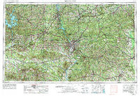
~ Phenix City AL topo map, 1:250000 scale, 1 X 2 Degree, Historical, 1955, updated 1974
Phenix City, Alabama, USGS topographic map dated 1955.
Includes geographic coordinates (latitude and longitude). This topographic map is suitable for hiking, camping, and exploring, or framing it as a wall map.
Printed on-demand using high resolution imagery, on heavy weight and acid free paper, or alternatively on a variety of synthetic materials.
Topos available on paper, Waterproof, Poly, or Tyvek. Usually shipping rolled, unless combined with other folded maps in one order.
- Product Number: USGS-5542919
- Free digital map download (high-resolution, GeoPDF): Phenix City, Alabama (file size: 28 MB)
- Map Size: please refer to the dimensions of the GeoPDF map above
- Weight (paper map): ca. 55 grams
- Map Type: POD USGS Topographic Map
- Map Series: HTMC
- Map Verison: Historical
- Cell ID: 68958
- Scan ID: 305933
- Imprint Year: 1974
- Woodland Tint: Yes
- Visual Version Number: 1
- Aerial Photo Year: 1972
- Edit Year: 1972
- Field Check Year: 1955
- Datum: Unstated
- Map Projection: Transverse Mercator
- Map published by United States Geological Survey
- Map published by: Military, Other
- Map Language: English
- Scanner Resolution: 600 dpi
- Map Cell Name: Phenix City
- Grid size: 1 X 2 Degree
- Date on map: 1955
- Map Scale: 1:250000
- Geographical region: Alabama, United States
Neighboring Maps:
All neighboring USGS topo maps are available for sale online at a variety of scales.
Spatial coverage:
Topo map Phenix City, Alabama, covers the geographical area associated the following places:
- Cole Ridge (historical) - Jester - Piney Grove - Meadows Crossroads - Whitesville - Carriage Hill - Friendship - Union - Mizell - Leesburg - Horns Crossroads - Union Springs - Jones Settlement - Wesley Heights - Westville - Eagle Creek - Ogletree Woods - Muscogee - Columbia Heights - Silvertown - Cunningham Crossroads - Fairfax - Midway - Sunset Terrace - Beans Mill - McRitchie Mill - Dudleyville - Jordanville - Nakomis - Goodwyn - Village Hills - Windsor Forest - Almeria - Gold Hill - Shady Grove - Louvale Station - Glen Haven - Charter Oaks - Uhland - Denson - Mount Andrew - Persons - Jamestown - Sturkie - Rest Haven - Loftin - Gatewood - Middle Brooks Crossroads - Hammett - Cherokee Park - Villula - Green Hill (historical) - Boromville - Sturdivant - Betts - Geneva - Hurtsboro - Alexander City - Forest Park - Pine Mountain Valley - Manta - Big Springs - Sunshine Acres - Yatesville - Upper Bradley Place - Hugley - Averett Woods - Moorefield - Valley View - Long Cane - Greens Mill - Wind Creek Farms - Piedmont Heights - Strouds - Wellington - Stonewall - Lakewood - Fox Chapel - Woodlawn Estates - Lancaster (historical) - Ida Vesper - Suspension - West Point - Roba - Hector - Five Points - Rowells Crossroads - Yuchi (historical) - Parkchester - Branton Woods - Jernigan - New Harmony - Uchee - Lokey Estates - Persico - Armstrong - Fontaine Village - Beall - Willow Creek Farms - Kowaliga
- Map Area ID: AREA3332-86-84
- Northwest corner Lat/Long code: USGSNW33-86
- Northeast corner Lat/Long code: USGSNE33-84
- Southwest corner Lat/Long code: USGSSW32-86
- Southeast corner Lat/Long code: USGSSE32-84
- Northern map edge Latitude: 33
- Southern map edge Latitude: 32
- Western map edge Longitude: -86
- Eastern map edge Longitude: -84

