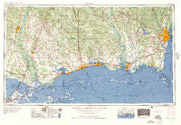
~ Mobile AL topo map, 1:250000 scale, 1 X 2 Degree, Historical, 1957, updated 1957
Mobile, Alabama, USGS topographic map dated 1957.
Includes geographic coordinates (latitude and longitude). This topographic map is suitable for hiking, camping, and exploring, or framing it as a wall map.
Printed on-demand using high resolution imagery, on heavy weight and acid free paper, or alternatively on a variety of synthetic materials.
Topos available on paper, Waterproof, Poly, or Tyvek. Usually shipping rolled, unless combined with other folded maps in one order.
- Product Number: USGS-5542889
- Free digital map download (high-resolution, GeoPDF): Mobile, Alabama (file size: 27 MB)
- Map Size: please refer to the dimensions of the GeoPDF map above
- Weight (paper map): ca. 55 grams
- Map Type: POD USGS Topographic Map
- Map Series: HTMC
- Map Verison: Historical
- Cell ID: 68917
- Scan ID: 305920
- Imprint Year: 1957
- Woodland Tint: Yes
- Field Check Year: 1953
- Datum: Unstated
- Map Projection: Transverse Mercator
- Map published by United States Army Corps of Engineers
- Map published by United States Army
- Map Language: English
- Scanner Resolution: 600 dpi
- Map Cell Name: Mobile
- Grid size: 1 X 2 Degree
- Date on map: 1957
- Map Scale: 1:250000
- Geographical region: Alabama, United States
Neighboring Maps:
All neighboring USGS topo maps are available for sale online at a variety of scales.
Spatial coverage:
Topo map Mobile, Alabama, covers the geographical area associated the following places:
- Dogwood Mobile Home Park - Smallwood Mobile Home Park - Bayou Oaks - Catahoula - Messer's Mobile Manor - Young - Cross Gates - Couves Mobile Home Park - Greendale Mobile Home Park - Camp Six (historical) - Twin Pines Mobile Home Park - Country Manor - Varnado - Magnolia Mobile Home Park - Jamar Mobile Home Park - New Hope - Country Squire Estates - Baker Mobile Home Park - Colt - Martin Bluff - Poticaw Landing - Old Americus - Clarke Gardens - Watson Place Trailer Park - Fruitland Park - Ozona - Lake Village - Hickory Hills - Riceville - Oak Manor Estates - Rowlands - Necaise - Sherwood Village Mobile Home Park - Slavonia (historical) - Kings Point - Vidalia Road Mobile Home Park - Evans Trailer Park - White Plains - Town Mobile Home Park - Brills Trailer Court - Scenic Hills - Lindberg Glen - Edgewater Park - Eight Mile - CNA Estates Mobile Home Park - Browns Mobile Park - Pass Christian - Southridge - Cooper Mobile Home Park - Michoud - Nenemoosha - Mauvilla Forest Estates - Orange Grove - Abney Estates - Beppo (historical) - Bayou Bend - Acropolis Heights - Rio - Lewis Mobile Park - North End - Cates Mobile Home Park - Pleasanton Hills Trailer Park - Smith Town - East Gentilly - Faustinas - Silver Run - Union Church - Saint Martin - McCall Landing - Gibson Landing - Tacon - Leetown - Fernwood Trailer Court - Crossroads Mobile Park - Hide-A-Way Lake - Henry Road Estates - Canebrake - Coll Town - Irvings (historical) - El Monte - Hawthorne - State Line - Glen Acres - Biloxi - Donovan (historical) - Pine Haven Mobile Home Village - Chamale Cove - Eagle Lake Mobile Home Park - Mill Creek - Bellamy (historical) - Saint Elmo - Shelton Beach Estates - Castle Manor - Indian Springs - French Branch Estates - Fowl River - Mauvilla - The Settlement - Caesar - Deerwood
- Map Area ID: AREA3130-90-88
- Northwest corner Lat/Long code: USGSNW31-90
- Northeast corner Lat/Long code: USGSNE31-88
- Southwest corner Lat/Long code: USGSSW30-90
- Southeast corner Lat/Long code: USGSSE30-88
- Northern map edge Latitude: 31
- Southern map edge Latitude: 30
- Western map edge Longitude: -90
- Eastern map edge Longitude: -88

