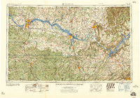
~ Gadsden AL topo map, 1:250000 scale, 1 X 2 Degree, Historical, 1958, updated 1958
Gadsden, Alabama, USGS topographic map dated 1958.
Includes geographic coordinates (latitude and longitude). This topographic map is suitable for hiking, camping, and exploring, or framing it as a wall map.
Printed on-demand using high resolution imagery, on heavy weight and acid free paper, or alternatively on a variety of synthetic materials.
Topos available on paper, Waterproof, Poly, or Tyvek. Usually shipping rolled, unless combined with other folded maps in one order.
- Product Number: USGS-5542879
- Free digital map download (high-resolution, GeoPDF): Gadsden, Alabama (file size: 27 MB)
- Map Size: please refer to the dimensions of the GeoPDF map above
- Weight (paper map): ca. 55 grams
- Map Type: POD USGS Topographic Map
- Map Series: HTMC
- Map Verison: Historical
- Cell ID: 68793
- Scan ID: 305915
- Imprint Year: 1958
- Woodland Tint: Yes
- Field Check Year: 1956
- Datum: Unstated
- Map Projection: Transverse Mercator
- Map published by United States Army Corps of Engineers
- Map published by United States Army
- Map Language: English
- Scanner Resolution: 600 dpi
- Map Cell Name: Gadsden
- Grid size: 1 X 2 Degree
- Date on map: 1958
- Map Scale: 1:250000
- Geographical region: Alabama, United States
Neighboring Maps:
All neighboring USGS topo maps are available for sale online at a variety of scales.
Spatial coverage:
Topo map Gadsden, Alabama, covers the geographical area associated the following places:
- Princeton - West Decatur - Five Points - Brookside - Ezell Place - Miller Subdivision - Flatwoods - Big Oak - Nix Mill - Northwood Park - Rutledge Heights - Westbury - Longwood - Red Bank - Butler Mill - Sommers South - Russell Hill - Fish Pond - Heritage Estates - Bainbridge (historical) - Flint City - Crowtown - Cedar Valley - Tharptown - Grove View Acres - Paradise Shores - Fairview West - Lakewood - Maple Hill - Somerville - Sauta (historical) - Proctor - Whitesboro - Smith Shores - Poplar Springs - Rabbittown - Danville - South Hill - Dyers Crossroads - Echols Hill - Edmond - Cypress Forest - Avoca (historical) - Penn - McLarty - Kaeiser Bottoms (historical) - Bowen (historical) - Johnsons Mill - Haden - Beachboro (historical) - Detroit Park - Pull Tight - Furnace Hill (historical) - Dallas - Egypt - Littleville - McCaleb Mill - Berrys (historical) - Village Pines - Lentzville - Rivermont - Hide Away Acres - Tuckahoe Heights - Lawson - Burgreen Gin - Canterbury - Ardmore Estates - Masterson Mill - Berkley - Chimney Springs - Lauderdale Beach - Davidsons Cross Roads (historical) - Harvest - Pane (historical) - High Point - Central Heights - Double Tree - Madison Point - Capshaw - Richmond Hills - Newport (historical) - Green Hills - Mount Zion (historical) - Parkway Estates - Sublett Mill - Old Monrovia - Sand Spring (historical) - Benson (historical) - Terry Heights - Northwood - Griffin Addition - Union - Hillsboro - Jones Valley Estates - Country Village - Neel - Oak Grove - Glendale Estates - Scoggins Bottoms (historical) - Oleander
- Map Area ID: AREA3534-88-86
- Northwest corner Lat/Long code: USGSNW35-88
- Northeast corner Lat/Long code: USGSNE35-86
- Southwest corner Lat/Long code: USGSSW34-88
- Southeast corner Lat/Long code: USGSSE34-86
- Northern map edge Latitude: 35
- Southern map edge Latitude: 34
- Western map edge Longitude: -88
- Eastern map edge Longitude: -86

