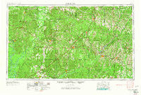
~ Andalusia AL topo map, 1:250000 scale, 1 X 2 Degree, Historical, 1953, updated 1965
Andalusia, Alabama, USGS topographic map dated 1953.
Includes geographic coordinates (latitude and longitude). This topographic map is suitable for hiking, camping, and exploring, or framing it as a wall map.
Printed on-demand using high resolution imagery, on heavy weight and acid free paper, or alternatively on a variety of synthetic materials.
Topos available on paper, Waterproof, Poly, or Tyvek. Usually shipping rolled, unless combined with other folded maps in one order.
- Product Number: USGS-5542855
- Free digital map download (high-resolution, GeoPDF): Andalusia, Alabama (file size: 22 MB)
- Map Size: please refer to the dimensions of the GeoPDF map above
- Weight (paper map): ca. 55 grams
- Map Type: POD USGS Topographic Map
- Map Series: HTMC
- Map Verison: Historical
- Cell ID: 68647
- Scan ID: 305903
- Imprint Year: 1965
- Woodland Tint: Yes
- Aerial Photo Year: 1952
- Edit Year: 1965
- Field Check Year: 1953
- Datum: Unstated
- Map Projection: Transverse Mercator
- Map published by United States Army Corps of Engineers
- Map published by United States Army
- Map Language: English
- Scanner Resolution: 600 dpi
- Map Cell Name: Andalusia
- Grid size: 1 X 2 Degree
- Date on map: 1953
- Map Scale: 1:250000
- Geographical region: Alabama, United States
Neighboring Maps:
All neighboring USGS topo maps are available for sale online at a variety of scales.
Spatial coverage:
Topo map Andalusia, Alabama, covers the geographical area associated the following places:
- Rural - Sheppard - Axle - Heath - Jack - Caledonia - Liberty - Center Ridge - Sand Cut - Franklin - McEntyre - Palmyra - Stanley - Wallace - Walker Springs - Peacock - Little Oak - Odom Crossroads - Red Oak - Greenwood - Montgomery Hill - Georgiaville - Vredenburgh - Fullers Crossroads - Pleasant Hill - Roberts - Olustee - Ino - Lottie - Goodway - Weeks - Parker Springs - Avant - Shawnee - Danielsville - Lenox - Castleberry - Straughn - Wald - Yellow Bluff - Chapel Hill - Whatley - Rutthven - Skinnerton - Midway - Hammac - Shacklesville - Greenville - Pebble Hill - Dry Forks - Belleville - Johnsonville - Poarch - Manningham - Choctaw Corner - Robinsonville - Coal Bluff - Atkeison - Fulton - Orion - Rabb - Spring Hill - Robinson Crossroads - Zoar - Evergreen - Mexboro - Antioch - China - River Falls - Howells - Green Bay - Flatwoods - Nichburg - Malta - Appleton - New Hope - Suggsville - Pea Ridge - Martinville - Dunns - Rock Hill - Starlington - Keith - Scyrene - Opine - River Ridge - East Brewton - Tallahatta Springs - Brewton - Shreve - Pineville - Allenton Station - Searcy - Pigeon Creek - Earlytown - Nymph - Shellhorn - Freemanville - Monroeville - Mexia
- Map Area ID: AREA3231-88-86
- Northwest corner Lat/Long code: USGSNW32-88
- Northeast corner Lat/Long code: USGSNE32-86
- Southwest corner Lat/Long code: USGSSW31-88
- Southeast corner Lat/Long code: USGSSE31-86
- Northern map edge Latitude: 32
- Southern map edge Latitude: 31
- Western map edge Longitude: -88
- Eastern map edge Longitude: -86

