
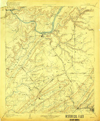
~ Gadsden AL topo map, 1:125000 scale, 30 X 30 Minute, Historical, 1903, updated 1920
Gadsden, Alabama, USGS topographic map dated 1903.
Includes geographic coordinates (latitude and longitude). This topographic map is suitable for hiking, camping, and exploring, or framing it as a wall map.
Printed on-demand using high resolution imagery, on heavy weight and acid free paper, or alternatively on a variety of synthetic materials.
Topos available on paper, Waterproof, Poly, or Tyvek. Usually shipping rolled, unless combined with other folded maps in one order.
- Product Number: USGS-5542753
- Free digital map download (high-resolution, GeoPDF): Gadsden, Alabama (file size: 7 MB)
- Map Size: please refer to the dimensions of the GeoPDF map above
- Weight (paper map): ca. 55 grams
- Map Type: POD USGS Topographic Map
- Map Series: HTMC
- Map Verison: Historical
- Cell ID: 65531
- Scan ID: 305846
- Imprint Year: 1920
- Survey Year: 1885
- Datum: Unstated
- Map Projection: Unstated
- Map published by United States Geological Survey
- Map Language: English
- Scanner Resolution: 600 dpi
- Map Cell Name: Gadsden
- Grid size: 30 X 30 Minute
- Date on map: 1903
- Map Scale: 1:125000
- Geographical region: Alabama, United States
Neighboring Maps:
All neighboring USGS topo maps are available for sale online at a variety of scales.
Spatial coverage:
Topo map Gadsden, Alabama, covers the geographical area associated the following places:
- Rhea (historical) - Holiday Shores - Smiths Chapel - Big Spring Creek Subdivision - High Point - Meltonsville - Martling - Bellevue - Ivalee - Alice - Stowers Hill - Albertville - Maryville - Sidney - Cottonville - Kyuka - Mays - Country Club Estates - Horton - Strawberry - Pleasant Hill - Double Bridges - Red Apple (historical) - Playground Shores - Hustleville - Henryville - Honeycomb Park - Johnson - Red Hill - Schuler (historical) - Cox Gap - Askea Grove - Hortons Mill - Pleasant Valley - McVille - Warrenton Subdivision - Agricola - Egypt - Mountain View - Morrow Acres - Half Acre Estates - Lindsay Lane - Marshall - Mount Hebron - Mount Carmel - Union - Smith Shores - Harrisville - Old Snead - Leath Gap (historical) - Liberty - Crossroads - Johnson (historical) - Littleton - Southtown - Monte Vista - Reedbrake (historical) - New Home - Mountainboro - Lamont (historical) - Redbud - South Hill - Signal Point Subdivision - Guntersville - Alder Springs - Oak Hill - Curtiston - Manchester - Stanfield (historical) - Jink (historical) - Sandy Point Subdivision - Ridgeville - Thirtynine (historical) - Rockledge - Pull Tight (historical) - Minorville (historical) - Five Forks - Mill Village - Asbury - Greer (historical) - Lathamville - Scenic Heights - Hide Away Acres - Sherwood Forest - Mount Zion (historical) - Happy Hollow - Noble Hill - Fort Deposit (historical) - Walnut Grove - Miller Subdivision - Diamond - The Highlands - Guntersville Shores - Pinedale Shores - Royse (historical) - Little New York - Whiton - Gregory (historical) - Altoona - Pana
- Map Area ID: AREA34.534-86.5-86
- Northwest corner Lat/Long code: USGSNW34.5-86.5
- Northeast corner Lat/Long code: USGSNE34.5-86
- Southwest corner Lat/Long code: USGSSW34-86.5
- Southeast corner Lat/Long code: USGSSE34-86
- Northern map edge Latitude: 34.5
- Southern map edge Latitude: 34
- Western map edge Longitude: -86.5
- Eastern map edge Longitude: -86


