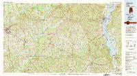
~ Troy AL topo map, 1:100000 scale, 30 X 60 Minute, Historical, 1981, updated 1982
Troy, Alabama, USGS topographic map dated 1981.
Includes geographic coordinates (latitude and longitude). This topographic map is suitable for hiking, camping, and exploring, or framing it as a wall map.
Printed on-demand using high resolution imagery, on heavy weight and acid free paper, or alternatively on a variety of synthetic materials.
Topos available on paper, Waterproof, Poly, or Tyvek. Usually shipping rolled, unless combined with other folded maps in one order.
- Product Number: USGS-5542637
- Free digital map download (high-resolution, GeoPDF): Troy, Alabama (file size: 34 MB)
- Map Size: please refer to the dimensions of the GeoPDF map above
- Weight (paper map): ca. 55 grams
- Map Type: POD USGS Topographic Map
- Map Series: HTMC
- Map Verison: Historical
- Cell ID: 68483
- Scan ID: 305780
- Imprint Year: 1982
- Woodland Tint: Yes
- Aerial Photo Year: 1972
- Edit Year: 1981
- Datum: NAD27
- Map Projection: Universal Transverse Mercator
- Map published by United States Geological Survey
- Map Language: English
- Scanner Resolution: 600 dpi
- Map Cell Name: Troy
- Grid size: 30 X 60 Minute
- Date on map: 1981
- Map Scale: 1:100000
- Geographical region: Alabama, United States
Neighboring Maps:
All neighboring USGS topo maps are available for sale online at a variety of scales.
Spatial coverage:
Topo map Troy, Alabama, covers the geographical area associated the following places:
- Lawrenceville - Oketeyeconne (historical) - Westview - White Oak - Enon - Pronto - Java - Asbury - Trojan Terrace - Barefield Crossroads - Teals Crossroads - Baxters - Dunn - Pine Ridge Estates - Dozier Trailer Park - North Ridge Mobile Home Park - Tennille - Bethel - Victoria - Pinewood Estates - Windmill Hills - Pleasant Hill - Tyler Crossroads - Fields (historical) - Laurel Grove (historical) - Ezell - Boot Hill - Gaino - Spio (historical) - Abbeville - Beamon - Lugo - Edwin - Cotton Hill - Days Crossroads - Green Ridge - Akinsville - Lowry Mill - Ridgewood - New Hope - Lewis - Blues Old Stand - Forest Circle - Richland - Perote - Dillard - Pierson Subdivision - Wills Crossroads - College Park - Centre Ridge (historical) - Lindsey - Mount Olive (historical) - Black Gum Corners (historical) - Mountainbrook - Greens Crossroads - Northdale - Clowers Crossroads - Moores Crossroads - Beans Crossroads - Clopton - Jamback - Louisville - Rocky Head - Elmhill Plantation - Logton - Clayton - Linwood - Tew - Union - Phillips Crossroads - Green Oaks - Antioch - Brantley Mobile Home Park - Otho - Sandy Point - Tarentum - Star Hill - Arguta - Stills Crossroads - Coates - Doster - Dozier Estates - Monticello - Corinth - Snells Crossroads - Oaks Heights - Hoboken - Big Eddy (historical) - Graball - Troy - Shiloh - McClure Town - Corcoran - Baker Hill - Ariton - Chestnut Grove - Hayes - White Oak - Ricks Place - Hamilton Crossroads
- Map Area ID: AREA3231.5-86-85
- Northwest corner Lat/Long code: USGSNW32-86
- Northeast corner Lat/Long code: USGSNE32-85
- Southwest corner Lat/Long code: USGSSW31.5-86
- Southeast corner Lat/Long code: USGSSE31.5-85
- Northern map edge Latitude: 32
- Southern map edge Latitude: 31.5
- Western map edge Longitude: -86
- Eastern map edge Longitude: -85

