
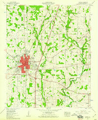
~ Athens AL topo map, 1:24000 scale, 7.5 X 7.5 Minute, Historical, 1958, updated 1959
Athens, Alabama, USGS topographic map dated 1958.
Includes geographic coordinates (latitude and longitude). This topographic map is suitable for hiking, camping, and exploring, or framing it as a wall map.
Printed on-demand using high resolution imagery, on heavy weight and acid free paper, or alternatively on a variety of synthetic materials.
Topos available on paper, Waterproof, Poly, or Tyvek. Usually shipping rolled, unless combined with other folded maps in one order.
- Product Number: USGS-5537657
- Free digital map download (high-resolution, GeoPDF): Athens, Alabama (file size: 11 MB)
- Map Size: please refer to the dimensions of the GeoPDF map above
- Weight (paper map): ca. 55 grams
- Map Type: POD USGS Topographic Map
- Map Series: HTMC
- Map Verison: Historical
- Cell ID: 1747
- Scan ID: 303154
- Imprint Year: 1959
- Woodland Tint: Yes
- Aerial Photo Year: 1949
- Field Check Year: 1958
- Datum: NAD27
- Map Projection: Polyconic
- Map published by United States Geological Survey
- Map Language: English
- Scanner Resolution: 600 dpi
- Map Cell Name: Athens
- Grid size: 7.5 X 7.5 Minute
- Date on map: 1958
- Map Scale: 1:24000
- Geographical region: Alabama, United States
Neighboring Maps:
All neighboring USGS topo maps are available for sale online at a variety of scales.
Spatial coverage:
Topo map Athens, Alabama, covers the geographical area associated the following places:
- Meadowbrook - Southside - Alabama Fork - Oakdale - Country Club Acres - Oakdale Acres - Hannah - East Hampton - Yorkshire - Campbell - Batts Heights - Pinedale Acres - Piney Chapel - Brookwood - Sommers South - Winslow - Bonnie Doone - Athens - Brookwood Forest - Cloverleaf - Fairmount - Bonneville - Mayflower - Lake Ida Heights - Whitfield - Lakewood - Belmont - Wigginsville - Sardis Springs - Indian Trace - French Mill - Cottonwood - Byram Heights - Country Village - Holland Place - Southview Manor
- Map Area ID: AREA34.87534.75-87-86.875
- Northwest corner Lat/Long code: USGSNW34.875-87
- Northeast corner Lat/Long code: USGSNE34.875-86.875
- Southwest corner Lat/Long code: USGSSW34.75-87
- Southeast corner Lat/Long code: USGSSE34.75-86.875
- Northern map edge Latitude: 34.875
- Southern map edge Latitude: 34.75
- Western map edge Longitude: -87
- Eastern map edge Longitude: -86.875


